|
search place name
|
||
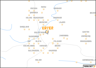
Kāyer (Ostān-e Āz̄arbāyjān-e Gharbī, Iran)Kāyer is a town in the Ostān-e Āz̄arbāyjān-e Gharbī region of Iran. An overview map of the region around Kāyer is displayed below.
regional and 3d topo map of Kāyer, Iran ::
Kāyer airports ::
The nearest airport is TBZ - Tabriz Intl, located 151.0 km north east of Kāyer.
Other airports nearby include VAN - Van (195.3 km north west), Nearby towns ::
Zīveh (1.5km north) //
Tūpūzābād (1.5km west) //
Manşūrābād (2.4km north west) //
Mīrābād (2.4km north west) //
Gerdevān (2.4km south east) //
Gerdīk (2.4km west) //
Golestāneh (2.6km west) //
Dīzaj (3.7km south east) //
Berāzān (4.0km north) //
Mollā Bāstak (3.5km south west) //
Tāzeh Kand (4.0km south) //
Lowrzīnā (4.7km south west) //
‘Aleyh (4.7km south west) //
Felekān (4.7km south east) //
Kānī Dastār (4.7km south east) //
Bībakrān (5.6km north) //
Kānesbī (5.8km south) //
Gerdīknāşer (5.8km north) //
Haftābād (5.8km north) //
Sūsanābād (4.8km south west) //
Zhārābād (5.1km east) //
Lājānī (5.8km north east) //
Sehgergān (6.3km north west) //
Zhārāzhī (5.8km south west) //
Bāvān (6.3km south east) //
Shīrakān (6.3km north east) //
Kīsīan (6.8km south) //
Cherīkābād (7.4km south) //
Berāsb (6.2km west) //
[all distances 'as the bird flies' and approximate] 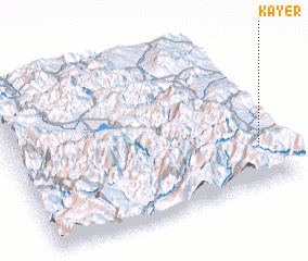 Places with similar names to Kāyer, Iran ::
Disclaimer :: Information on this page comes without warranty of any kind |
||
|
Where is Kāyer? Elevation and coordinates ::
Latitude (lat): 37°15'0"N Longitude (lon): 44°56'0"E
Elevation (approx.): 1503m (map arrows pan, magnifying glasses zoom) |
||
|
Visiting Kāyer? Hotel/Accommodation ::
Book a hotel in Kāyer Travel Guide ::
Buy a travel guide for Iran rental cars ::
car rental offers GPS waypoint ::
download a GPX waypoint (PoI) of Kāyer for your GPS receiver
|
||