|
search place name
|
||
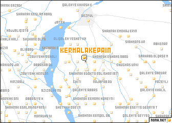
Kermalak-e Pāʼīn (Khūzestān, Iran)Kermalak-e Pāʼīn is a town in the Khūzestān region of Iran. An overview map of the region around Kermalak-e Pāʼīn is displayed below.
regional and 3d topo map of Kermalak-e Pāʼīn, Iran ::
Kermalak-e Pāʼīn airports ::
The nearest airport is QMJ - Masjed Soleiman Shahid Asyaee, located 88.5 km east of Kermalak-e Pāʼīn.
Other airports nearby include AWZ - Ahwaz (112.1 km south), MRX - Bandar Mahshahr Mahshahr (206.1 km south), BSR - Basrah Intl (206.4 km south), ABD - Abadan (214.5 km south), Nearby towns ::
Kar Malek (0.0km north) //
‘Alī Kowlī (1.7km south) //
Gartoshmāl-e Talkor (1.9km south) //
Shamsābād (1.6km east) //
Kermalak-e Bālā (1.9km north) //
Anjīrak (1.6km east) //
Dehbar (1.6km west) //
Qal‘eh-ye Seyyed (1.6km east) //
Khalţeh (1.6km east) //
Qālvand (2.4km south west) //
Qal‘eh-ye Khelţeh (2.4km south east) //
Qal‘eh-ye Rob‘-e Bandbāl (2.4km north east) //
Boneh-ye Aqā Asad (3.1km west) //
Shahrak-e Towḩīd (3.1km east) //
Shahrak-e Āyatollāh Montaz̧erī (4.0km south west) //
Qal‘eh-ye Sheykh (3.6km north west) //
Shahrak-e Moḩammad Ebn-e Ja‘far (3.6km north west) //
Shahrak-e Doktor ‘Alī Sharī‘atī (4.0km south east) //
Qal‘eh-ye Now Bīsheh (3.6km south east) //
Qal‘eh Now Shamsābād (3.6km north east) //
Ḩoseynābād-e Band-e Bāl (4.0km north west) //
Band-e Bāl (4.0km north west) //
Zāvīyeh Ḩamūdī (3.8km west) //
‘Alī Qal‘eh-ye Sheykh (4.7km north west) //
Qal‘eh-ye Qāẕī (4.9km south east) //
Qal‘eh-ye Khākestarī (4.9km south east) //
Kheyrābād (4.9km south east) //
Shahrak-e Shamsābād (4.7km east) //
Boneh-ye Ḩāj ‘Abd ol Moḩammad (4.7km east) //
[all distances 'as the bird flies' and approximate] 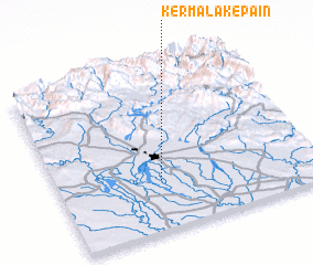 Places with similar names to Kermalak-e Pāʼīn, Iran :: Disclaimer :: Information on this page comes without warranty of any kind |
||
|
Where is Kermalak-e Pāʼīn? Elevation and coordinates ::
Latitude (lat): 32°18'0"N Longitude (lon): 48°24'0"E
Elevation (approx.): 96m (map arrows pan, magnifying glasses zoom) |
||
|
Visiting Kermalak-e Pāʼīn? Hotel/Accommodation ::
Book a hotel in Kermalak-e Pāʼīn Travel Guide ::
Buy a travel guide for Iran rental cars ::
car rental offers GPS waypoint ::
download a GPX waypoint (PoI) of Kermalak-e Pāʼīn for your GPS receiver
|
||