|
search place name
|
||
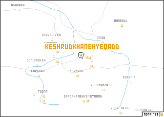
Kesh Rūdkhāneh-ye Qadd (Hormozgān, Iran)Kesh Rūdkhāneh-ye Qadd is a town in the Hormozgān region of Iran. An overview map of the region around Kesh Rūdkhāneh-ye Qadd is displayed below.
regional and 3d topo map of Kesh Rūdkhāneh-ye Qadd, Iran ::
Kesh Rūdkhāneh-ye Qadd airports ::
The nearest airport is BND - Bandar Abbass Intl, located 92.1 km south of Kesh Rūdkhāneh-ye Qadd.
Other airports nearby include KHS - Khasab (208.3 km south), BDH - Bandar Lengeh (224.9 km south west), Nearby towns ::
Raḩīmābād (0.9km east) //
Kash Rūdkhāneh (1.1km north) //
Na‘īmābād (1.5km east) //
Nez̧āmābād-e Fāreghān (2.1km east) //
Shāhrūd-e Fāreghān (2.6km south east) //
Qareh Ghūyeh (3.1km north west) //
Meymand (4.1km south) //
Mazra‘eh (5.0km west) //
Mowrdū'īyeh (5.3km north west) //
Nesā' (5.4km north east) //
Deh Morshed (5.2km west) //
Kamālī (5.4km west) //
Tālīshī (5.4km west) //
Darreh Nārūn (5.4km west) //
Bandī-ye Kūh (5.7km west) //
Deh Qā‘ed (6.4km west) //
Deh Qāt (6.4km west) //
Darreh Bārīk (6.9km west) //
Kharsū'īyeh (7.4km north west) //
Emāmzādeh ‘Alī (8.4km south east) //
Tū Dar (11.7km south west) //
[all distances 'as the bird flies' and approximate] 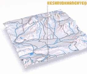 Places with similar names to Kesh Rūdkhāneh-ye Qadd, Iran :: Disclaimer :: Information on this page comes without warranty of any kind |
||
|
Where is Kesh Rūdkhāneh-ye Qadd? Elevation and coordinates ::
Latitude (lat): 28°2'55"N Longitude (lon): 56°20'4"E
Elevation (approx.): 1080m (map arrows pan, magnifying glasses zoom) |
||
|
Visiting Kesh Rūdkhāneh-ye Qadd? Hotel/Accommodation ::
Book a hotel in Kesh Rūdkhāneh-ye Qadd Travel Guide ::
Buy a travel guide for Iran rental cars ::
car rental offers GPS waypoint ::
download a GPX waypoint (PoI) of Kesh Rūdkhāneh-ye Qadd for your GPS receiver
|
||