|
search place name
|
||
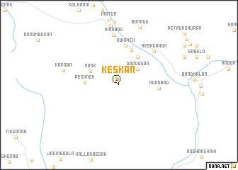
Keskān (Sīstān va Balūchestān, Iran)Keskān is a town in the Sīstān va Balūchestān region of Iran. An overview map of the region around Keskān is displayed below.
regional and 3d topo map of Keskān, Iran ::
Keskān airports ::
The nearest airport is ZBR - Chah Bahar, located 152.2 km south east of Keskān.
Nearby towns ::
Dorūdgān (3.6km north east) //
Rāmk (4.6km north west) //
Veshgān (5.1km north east) //
Peshnek (4.8km west) //
Kūrashk (5.8km north) //
Kūh Pīch (6.3km north) //
Nūkābād (5.7km east) //
Meshgāhom (7.3km north east) //
Mīrābād (7.9km north) //
Karnān (8.2km west) //
[all distances 'as the bird flies' and approximate] 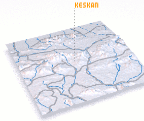 Places with similar names to Keskān, Iran ::
Disclaimer :: Information on this page comes without warranty of any kind |
||
|
Where is Keskān? Elevation and coordinates ::
Latitude (lat): 26°34'38"N Longitude (lon): 59°31'25"E
Elevation (approx.): 833m (map arrows pan, magnifying glasses zoom) |
||
|
Visiting Keskān? Hotel/Accommodation ::
Book a hotel in Keskān Travel Guide ::
Buy a travel guide for Iran rental cars ::
car rental offers GPS waypoint ::
download a GPX waypoint (PoI) of Keskān for your GPS receiver
|
||