|
search place name
|
||
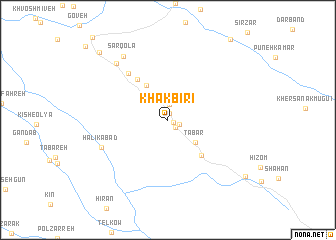
Khākbīrī (Eşfahān, Iran)Khākbīrī is a town in the Eşfahān region of Iran. An overview map of the region around Khākbīrī is displayed below.
regional and 3d topo map of Khākbīrī, Iran ::
Khākbīrī airports ::
The nearest airport is QMJ - Masjed Soleiman Shahid Asyaee, located 109.5 km south west of Khākbīrī.
Other airports nearby include AWZ - Ahwaz (197.4 km south west), Nearby towns ::
Vārnā (0.6km south east) //
Bondar (0.7km north) //
Maşīr (1.1km south east) //
Pasūnkhar (1.1km south east) //
Āchak (1.7km north) //
Tabar (3.6km south east) //
Ţorzeh (3.9km north west) //
Bābā Khosrow (4.3km north west) //
Homeh (5.0km south east) //
‘Anāyesht (5.4km north west) //
Darreh-ye Chīleh (6.4km north west) //
Halīkābād (6.9km south west) //
Ḩabībak (7.9km north west) //
Sar Qolā‘ (8.3km north west) //
Pashandegān (9.7km south east) //
Bahrāmābād (9.9km north west) //
[all distances 'as the bird flies' and approximate] 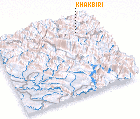
Disclaimer :: Information on this page comes without warranty of any kind |
||
|
Where is Khākbīrī? Elevation and coordinates ::
Latitude (lat): 32°52'9"N Longitude (lon): 49°49'41"E
Elevation (approx.): 2534m (map arrows pan, magnifying glasses zoom) |
||
|
Visiting Khākbīrī? Hotel/Accommodation ::
Book a hotel in Khākbīrī Travel Guide ::
Buy a travel guide for Iran rental cars ::
car rental offers GPS waypoint ::
download a GPX waypoint (PoI) of Khākbīrī for your GPS receiver
|
||