|
search place name
|
||
Khalaf Anşār (Kermān, Iran)Khalaf Anşār is a town in the Kermān region of Iran. An overview map of the region around Khalaf Anşār is displayed below.
regional and 3d topo map of Khalaf Anşār, Iran ::

Khalaf Anşār airports ::
The nearest airport is TBZ - Tabriz Intl, located 41.8 km south west of Khalaf Anşār.
Nearby towns ::
Īshaqlū (1.5km east) //
Kheneslū (2.4km north east) //
Būrūn Daraq (3.4km south west) //
Şamşām Kandī (4.4km west) //
Chāy Kandī-ye Kheyr ed Dīn (5.6km north east) //
Qareh Bolāgh (6.4km north) //
Qeshlāq-e Bālā (6.3km south west) //
Meshk-e ‘Anbar (5.9km west) //
Cherāghlū (6.1km east) //
Ḩammāmlū (7.9km north) //
Qeshlāq-e Pāʼīn (8.0km south) //
Moshīrābād (8.0km south) //
Debaklū (6.9km south east) //
Debaklū (7.7km south east) //
Dībeklū (7.7km south east) //
Kheyr od Dīn (7.8km north east) //
Qeshlāq-e Pā'īn (8.6km south west) //
Alahrod (8.9km north west) //
Neycharān (9.4km south east) //
Harzandīq (9.4km south east) //
[all distances 'as the bird flies' and approximate] 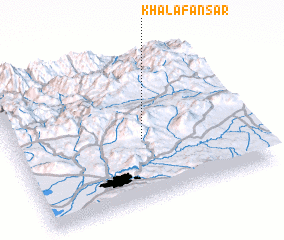 Places with similar names to Khalaf Anşār, Iran :: Disclaimer :: Information on this page comes without warranty of any kind |
||
|
Where is Khalaf Anşār? Elevation and coordinates ::
Latitude (lat): 38°25'0"N Longitude (lon): 46°33'0"E
Elevation (approx.): 2310m (map arrows pan, magnifying glasses zoom) |
||
|
Visiting Khalaf Anşār? Hotel/Accommodation ::
Book a hotel in Khalaf Anşār Travel Guide ::
Buy a travel guide for Iran rental cars ::
car rental offers GPS waypoint ::
download a GPX waypoint (PoI) of Khalaf Anşār for your GPS receiver
|
||