|
search place name
|
||
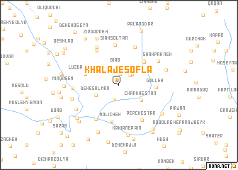
Khalaj-e Soflá (Lorestān, Iran)Khalaj-e Soflá is a town in the Lorestān region of Iran. An overview map of the region around Khalaj-e Soflá is displayed below.
regional and 3d topo map of Khalaj-e Soflá, Iran ::
Khalaj-e Soflá airports ::
The nearest airport is QMJ - Masjed Soleiman Shahid Asyaee, located 186.7 km south of Khalaj-e Soflá.
Nearby towns ::
Maḩmūdābād-e Bīāb (1.7km north) //
Khalaj-e ‘Olyā (2.0km north east) //
Bājgīrān (2.3km south) //
Khalaj-e ‘Olyā (2.4km north east) //
Bīāb (2.9km north) //
Deh-e Salmān (3.4km south west) //
Charkhestān (3.8km south east) //
Panj Zowj (4.5km north east) //
Dāvūd-e Peyghambar (4.8km north east) //
Bīdestān (5.0km north east) //
Lowzdar-e Vasaţī (4.7km west) //
Lūz-e Vosţá (4.8km west) //
Lūzdar-e ‘Olyā (4.8km west) //
Galleh (4.8km east) //
Mālīcheh (5.9km south) //
Sīāh Solţān (6.4km north) //
Borj-e Cheshmeh-ye Maḩmūd (6.3km north) //
Lūzdarbā (6.2km north west) //
Qal‘eh-ye Khalīfeh (6.2km south west) //
Perchestān (6.3km south east) //
Deh-e Āqā (6.7km north west) //
Shāh Pahneh (6.4km north east) //
Lūzdar-e Vosţá (6.1km west) //
Nez̧āmābād (6.5km west) //
Ḩasanābād (6.8km south west) //
Bozdāsh (6.6km east) //
Kāmīān-e Pāʼīn (8.0km south) //
Zīrdarreh (7.8km north) //
Darreh-ye Zūleh (7.9km south) //
[all distances 'as the bird flies' and approximate] 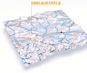 Places with similar names to Khalaj-e Soflá, Iran :: Disclaimer :: Information on this page comes without warranty of any kind |
||
|
Where is Khalaj-e Soflá? Elevation and coordinates ::
Latitude (lat): 33°41'4"N Longitude (lon): 49°20'53"E
Elevation (approx.): 2013m (map arrows pan, magnifying glasses zoom) |
||
|
Visiting Khalaj-e Soflá? Hotel/Accommodation ::
Book a hotel in Khalaj-e Soflá Travel Guide ::
Buy a travel guide for Iran rental cars ::
car rental offers GPS waypoint ::
download a GPX waypoint (PoI) of Khalaj-e Soflá for your GPS receiver
|
||