|
search place name
|
||
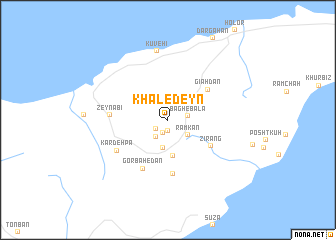
Khāledeyn (Hormozgān, Iran)Khāledeyn is a town in the Hormozgān region of Iran. An overview map of the region around Khāledeyn is displayed below.
regional and 3d topo map of Khāledeyn, Iran ::
Khāledeyn airports ::
The nearest airport is BND - Bandar Abbass Intl, located 51.6 km north east of Khāledeyn.
Other airports nearby include KHS - Khasab (82.0 km south), BDH - Bandar Lengeh (124.8 km west), RKT - Ras Al Khaimah Intl (140.9 km south), SHJ - Sharjah Intl (179.3 km south), Nearby towns ::
Tūrīān (1.2km south) //
Zandīān (1.5km south) //
Tomsenatī (1.5km south west) //
Bāgh-e Bālā (2.1km east) //
Kārevān (2.3km south west) //
Ramkān (2.6km south east) //
Kūshah (3.2km south) //
Jījīān (4.1km south) //
Gīāhdān (5.2km north east) //
Zīrāng (5.2km south east) //
Gazdān (6.1km south) //
Gorbahedān (6.0km south west) //
Zeynabī (5.8km west) //
Kardeh Pā (6.2km south west) //
Kūveh'ī (7.8km north) //
[all distances 'as the bird flies' and approximate] 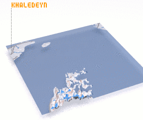 Places with similar names to Khāledeyn, Iran ::
Disclaimer :: Information on this page comes without warranty of any kind |
||
|
Where is Khāledeyn? Elevation and coordinates ::
Latitude (lat): 26°52'59"N Longitude (lon): 56°0'59"E
Elevation (approx.): 40m (map arrows pan, magnifying glasses zoom) |
||
|
Visiting Khāledeyn? Hotel/Accommodation ::
Book a hotel in Khāledeyn Travel Guide ::
Buy a travel guide for Iran rental cars ::
car rental offers GPS waypoint ::
download a GPX waypoint (PoI) of Khāledeyn for your GPS receiver
|
||