|
search place name
|
||
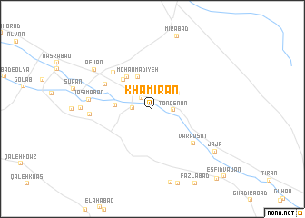
Khamīrān (Eşfahān, Iran)Khamīrān is a town in the Eşfahān region of Iran. An overview map of the region around Khamīrān is displayed below.
regional and 3d topo map of Khamīrān, Iran ::
Khamīrān airports ::
The nearest airport is QMJ - Masjed Soleiman Shahid Asyaee, located 186.1 km south west of Khamīrān.
Nearby towns ::
Ja‘farābād (1.8km north west) //
Hūmān (2.1km west) //
Tonderān (2.1km east) //
Āfjān (3.2km north east) //
Moḩammadīyeh (4.2km north) //
Kheyrābād (3.9km west) //
Mehdīābād (4.8km north west) //
Mūhān (4.7km north west) //
Mobārakeh (6.0km north west) //
Var Posht (6.0km south east) //
Aḩmadābād (5.8km north west) //
Ḩasanābād-e Vosţá (6.5km west) //
Nasīmābād (6.7km west) //
Afjān (7.7km north west) //
Qāsemābād (7.5km west) //
Jā Jā (8.4km south east) //
Arrān (10.8km south east) //
Esfīd Vājān (11.1km south east) //
[all distances 'as the bird flies' and approximate] 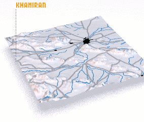 Places with similar names to Khamīrān, Iran ::
// Khimrana (IN)
// Khomeyrān (IR)
// Khomīrān (IR)
// Khambrān (PK)
// Khambriān (PK)
// Khoumérion (GR)
// Khoumérion (GR)
Disclaimer :: Information on this page comes without warranty of any kind |
||
|
Where is Khamīrān? Elevation and coordinates ::
Latitude (lat): 32°46'57"N Longitude (lon): 51°1'20"E
Elevation (approx.): 1984m (map arrows pan, magnifying glasses zoom) |
||
|
Visiting Khamīrān? Hotel/Accommodation ::
Book a hotel in Khamīrān Travel Guide ::
Buy a travel guide for Iran rental cars ::
car rental offers GPS waypoint ::
download a GPX waypoint (PoI) of Khamīrān for your GPS receiver
|
||