|
search place name
|
||
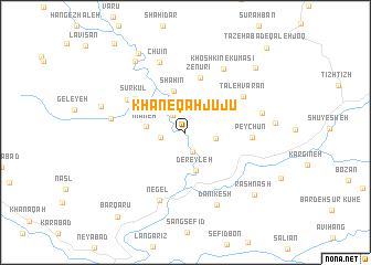
Khāneqāh Jūjū (Kordestān, Iran)Khāneqāh Jūjū is a town in the Kordestān region of Iran. An overview map of the region around Khāneqāh Jūjū is displayed below.
regional and 3d topo map of Khāneqāh Jūjū, Iran ::
Khāneqāh Jūjū airports ::
The nearest airport is SDG - Sanandaj, located 43.8 km east of Khāneqāh Jūjū.
Other airports nearby include KSH - Bakhtaran Shahid Ashrafi Esfahani (124.9 km south east), Nearby towns ::
Bāqelābād (2.0km north west) //
Boney Darreh (2.1km south) //
Zovenj (2.2km west) //
Kūh-e Panāh Qūreh (2.6km east) //
Dereyleh (4.0km south) //
Mīāneh (3.3km west) //
Shāhīn (4.3km north) //
Zenūrī (5.7km north) //
Sūrkūl (5.4km north west) //
Sorkh Kūl (5.8km north west) //
Peychūn (5.5km east) //
Ţāleh Varān (6.0km north east) //
Negel (7.2km south) //
Khoshkīn-e Kūmāsī (7.1km north east) //
Chūʼīn (7.4km north) //
Neyzal (6.3km west) //
Dānīkesh (7.7km south) //
Kūh-e Bardeh Galāneh (6.6km east) //
Pīr Kheẕrān (8.3km north west) //
Bīdarreh (7.4km west) //
Pīr Khezer Shāhū (8.9km north west) //
Rashnash (8.5km south east) //
Gezer Darreh (8.7km north east) //
Barqarū (10.2km south west) //
Tāzehābād-e Qal‘eh Joq (10.8km north east) //
[all distances 'as the bird flies' and approximate] 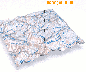 Places with similar names to Khāneqāh Jūjū, Iran :: Disclaimer :: Information on this page comes without warranty of any kind |
||
|
Where is Khāneqāh Jūjū? Elevation and coordinates ::
Latitude (lat): 35°21'8"N Longitude (lon): 46°32'44"E
Elevation (approx.): 1453m (map arrows pan, magnifying glasses zoom) |
||
|
Visiting Khāneqāh Jūjū? Hotel/Accommodation ::
Book a hotel in Khāneqāh Jūjū Travel Guide ::
Buy a travel guide for Iran rental cars ::
car rental offers GPS waypoint ::
download a GPX waypoint (PoI) of Khāneqāh Jūjū for your GPS receiver
|
||