|
search place name
|
||
Khānom Bālā Kandī (Ardabīl, Iran)Khānom Bālā Kandī is a town in the Ardabīl region of Iran. An overview map of the region around Khānom Bālā Kandī is displayed below.
regional and 3d topo map of Khānom Bālā Kandī, Iran ::

Khānom Bālā Kandī airports ::
The nearest airport is TBZ - Tabriz Intl, located 144.1 km west of Khānom Bālā Kandī.
Other airports nearby include RAS - Rasht (171.6 km south east), Nearby towns ::
Tablak (0.8km east) //
Valī-ye ‘Aşr (3.3km south east) //
Şā'īn Garūkī (5.0km south) //
Īrīnchī (5.3km north east) //
Būrān (4.8km north east) //
Saqqezchī (5.6km north west) //
Īrenjī (6.1km north east) //
Kalāntar-e Soflá (6.7km north west) //
Kalāntar-e ‘Olyā (6.7km north west) //
Sorkhāb (7.2km north east) //
Dībaklū (6.8km north west) //
Deymān (7.1km north east) //
Sārī Qayah (8.4km south) //
Ūrtā Kand (8.4km south) //
Valī ‘Aşr (7.0km south east) //
Emām Chāy (8.6km south) //
Qareh Tappeh (7.4km east) //
Gūgarchīn (9.0km north) //
Ḩeydarābād (9.6km north west) //
Şandūqlū (9.6km north west) //
Mazra‘eh (9.9km north east) //
[all distances 'as the bird flies' and approximate] 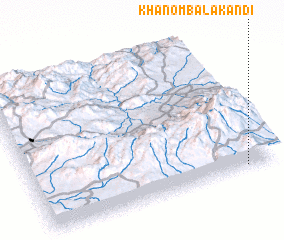 Places with similar names to Khānom Bālā Kandī, Iran :: Disclaimer :: Information on this page comes without warranty of any kind |
||
|
Where is Khānom Bālā Kandī? Elevation and coordinates ::
Latitude (lat): 38°1'30"N Longitude (lon): 47°52'18"E
Elevation (approx.): 2288m (map arrows pan, magnifying glasses zoom) |
||
|
Visiting Khānom Bālā Kandī? Hotel/Accommodation ::
Book a hotel in Khānom Bālā Kandī Travel Guide ::
Buy a travel guide for Iran rental cars ::
car rental offers GPS waypoint ::
download a GPX waypoint (PoI) of Khānom Bālā Kandī for your GPS receiver
|
||