|
search place name
|
||
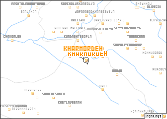
Khar Mordeh (Lorestān, Iran)Khar Mordeh is a town in the Lorestān region of Iran. An overview map of the region around Khar Mordeh is displayed below.
regional and 3d topo map of Khar Mordeh, Iran ::
Khar Mordeh airports ::
The nearest airport is KSH - Bakhtaran Shahid Ashrafi Esfahani, located 76.4 km north of Khar Mordeh.
Other airports nearby include SDG - Sanandaj (176.3 km north), QMJ - Masjed Soleiman Shahid Asyaee (254.9 km south east), Nearby towns ::
Khar Mordeh (1.3km south east) //
Dūreh Derāz (1.9km north west) //
Mīān Maleh (2.2km east) //
Ākheh ‘Abbāsī (2.6km west) //
Sarkūreh-ye Nūr Khodā (3.7km east) //
Kūrdasht-e Soflá (4.4km north) //
Owlād-e Qobād Dīālan (3.8km east) //
Tekyeh-ye Dīālī (4.4km north east) //
Malek ‘Alī (6.2km north) //
Tūrem (6.2km north) //
Sareyn-e Pīāmen (6.2km north) //
Kūrdasht-e ‘Olyā (6.7km north east) //
Rūberah (7.4km north west) //
Kalegah (8.1km north) //
Dīālī (7.7km south east) //
Nāmjū (7.2km south east) //
Bahāreh Dūl (8.3km north west) //
Varehzard (8.8km north east) //
Sīāh Cheshmeh (10.3km south west) //
Beyq Moḩammad (10.5km north east) //
Esmā‘īl (10.5km north east) //
[all distances 'as the bird flies' and approximate] 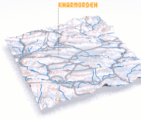 Places with similar names to Khar Mordeh, Iran ::
Disclaimer :: Information on this page comes without warranty of any kind |
||
|
Where is Khar Mordeh? Elevation and coordinates ::
Latitude (lat): 33°41'41"N Longitude (lon): 47°25'38"E
Elevation (approx.): 1232m (map arrows pan, magnifying glasses zoom) |
||
|
Visiting Khar Mordeh? Hotel/Accommodation ::
Book a hotel in Khar Mordeh Travel Guide ::
Buy a travel guide for Iran rental cars ::
car rental offers GPS waypoint ::
download a GPX waypoint (PoI) of Khar Mordeh for your GPS receiver
|
||