|
search place name
|
||
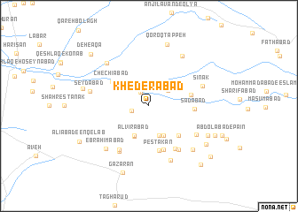
Khederābād (Iran)Khederābād is a town in Iran. An overview map of the region around Khederābād is displayed below.
regional and 3d topo map of Khederābād, Iran ::
Khederābād airports ::
The nearest airport is THR - Teheran Mehrabad Intl, located 116.2 km north east of Khederābād.
Nearby towns ::
Qalandarīyeh (2.0km north west) //
Edrīsābād (1.9km west) //
Majīdābād (2.8km north east) //
Şeydābād (3.9km south) //
Alvīrābād (4.0km south) //
Nūrābād (4.0km south) //
Moqbelābād (4.0km south) //
Vazīr (4.2km south) //
Dowlatābād (4.8km south east) //
Khorramābād (4.5km east) //
Chechīābād (4.9km north west) //
Sa‘dābād (4.7km east) //
Pestakān (5.7km south) //
Qezelābād (5.8km south) //
Najmābād (5.8km south) //
Pāchīān (6.0km south east) //
‘Askarlī (6.3km south west) //
Karīmābād (6.3km south east) //
Bāqerābād (6.5km south west) //
Sharīfābād-e Zand (6.1km south east) //
Sīnak (6.0km north east) //
Ja‘farābād (7.2km south) //
Qal‘eh-ye ‘Abdollāh (7.2km north east) //
Deh-e Āqā (7.0km north west) //
Şeydābād (6.4km west) //
Ebrāhīmābād (7.0km south west) //
Shāhbostān (7.2km south east) //
Ḩeydarābād (7.2km south east) //
Qoroq Tappeh (8.0km north) //
[all distances 'as the bird flies' and approximate] 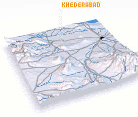 Places with similar names to Khederābād, Iran ::
// Khatyrabyt (RU)
// Khaţīrābād (IR)
// Khederābād (IR)
// Khederābād (IR)
// Khedrābād (IR)
// Kūh-e Torbat (IR)
Disclaimer :: Information on this page comes without warranty of any kind |
||
|
Where is Khederābād? Elevation and coordinates ::
Latitude (lat): 34°51'0"N Longitude (lon): 50°33'0"E
Elevation (approx.): 921m (map arrows pan, magnifying glasses zoom) |
||
|
Visiting Khederābād? Hotel/Accommodation ::
Book a hotel in Khederābād Travel Guide ::
Buy a travel guide for Iran rental cars ::
car rental offers GPS waypoint ::
download a GPX waypoint (PoI) of Khederābād for your GPS receiver
|
||