|
search place name
|
||
Khīgān (Hamadān, Iran)Khīgān is a town in the Hamadān region of Iran. An overview map of the region around Khīgān is displayed below.
regional and 3d topo map of Khīgān, Iran ::

Khīgān airports ::
The nearest airport is KSH - Bakhtaran Shahid Ashrafi Esfahani, located 202.5 km south west of Khīgān.
Other airports nearby include RZR - Ramsar (230.7 km north east), Nearby towns ::
Emāmzādeh Qāsem (0.0km north) //
Sīrāb (1.9km north) //
Now Deh (2.4km south east) //
Takyeh (3.7km north) //
Posht Jīn (3.0km east) //
Kahārd (3.7km south) //
Amīrīyeh (3.5km south west) //
Nīyar (4.0km south) //
Kahārd (4.8km south west) //
Navār (4.8km north east) //
Kheyrābād (4.8km south west) //
Khomeygān (5.8km north) //
Razan (6.5km north) //
Nez̧āmābād (5.9km north east) //
Mādābād (5.9km north west) //
Yengeh Qal‘eh (6.3km north east) //
Fārsejīn (6.5km north east) //
Darjazīn (6.9km north east) //
Sāyān (7.8km south east) //
Āq Kand (7.1km north west) //
Qorveh (7.2km east) //
Varvazīn (8.2km north west) //
Boḩkandān (8.2km south east) //
Rakīn (9.6km south east) //
[all distances 'as the bird flies' and approximate] 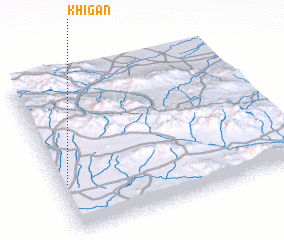 Places with similar names to Khīgān, Iran ::
Disclaimer :: Information on this page comes without warranty of any kind |
||
|
Where is Khīgān? Elevation and coordinates ::
Latitude (lat): 35°19'0"N Longitude (lon): 49°2'0"E
Elevation (approx.): 1769m (map arrows pan, magnifying glasses zoom) |
||
|
Visiting Khīgān? Hotel/Accommodation ::
Book a hotel in Khīgān Travel Guide ::
Buy a travel guide for Iran rental cars ::
car rental offers GPS waypoint ::
download a GPX waypoint (PoI) of Khīgān for your GPS receiver
|
||