|
search place name
|
||
Khorram Makān (Fārs, Iran)Khorram Makān is a town in the Fārs region of Iran. An overview map of the region around Khorram Makān is displayed below.
regional and 3d topo map of Khorram Makān, Iran ::

Khorram Makān airports ::
The nearest airport is SYZ - Shiraz Shahid Dastghaib Intl, located 84.8 km south of Khorram Makān.
Other airports nearby include BUZ - Bushehr (204.5 km south west), AZD - Yazd Shahid Sadooghi (261.4 km north east), Nearby towns ::
Qal‘eh Now Bālā (1.8km south west) //
Beţaraf-e Sadd-e Dorūdzan (2.0km north west) //
Khvājeh Yahūd (3.2km south) //
Bāgh-e Now (2.9km south east) //
Manşūrābād (3.4km west) //
Manşūrābād (3.7km north east) //
Ḩoseynābād (4.3km north) //
Tol Sorkh (5.2km south east) //
‘Abbāsābād (5.5km north west) //
Pālangarī-ye Kohneh (6.1km north) //
Garpāch (5.5km south east) //
Owbād (5.7km west) //
Dankūn (5.8km west) //
‘Ādelābād (6.1km south east) //
Pālangarī-ye Now (7.5km north west) //
Ḩājjīābād (7.1km south east) //
Bakīān (8.6km north) //
Qayyemābād (8.5km south east) //
Qal‘eh Now-ye Pā'īn (8.2km south east) //
Khānīman (8.9km north west) //
Cham-e Rīz (9.9km south east) //
[all distances 'as the bird flies' and approximate] 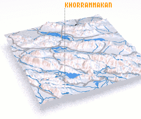 Places with similar names to Khorram Makān, Iran ::
// Cahermacun (IE)
Disclaimer :: Information on this page comes without warranty of any kind |
||
|
Where is Khorram Makān? Elevation and coordinates ::
Latitude (lat): 30°15'52"N Longitude (lon): 52°18'34"E
Elevation (approx.): 1674m (map arrows pan, magnifying glasses zoom) |
||
|
Visiting Khorram Makān? Hotel/Accommodation ::
Book a hotel in Khorram Makān Travel Guide ::
Buy a travel guide for Iran rental cars ::
car rental offers GPS waypoint ::
download a GPX waypoint (PoI) of Khorram Makān for your GPS receiver
|
||