|
search place name
|
||
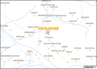
Khvājehhā (Khorāsān, Iran)Khvājehhā is a town in the Khorāsān region of Iran. An overview map of the region around Khvājehhā is displayed below.
regional and 3d topo map of Khvājehhā, Iran ::
Khvājehhā airports ::
The nearest airport is ASB - Ashkhabad Ashgabat, located 76.5 km north of Khvājehhā.
Nearby towns ::
Khabūshān (1.5km north) //
Tītkānlū (2.1km south) //
Āq Bāgh (4.2km north) //
Qal‘eh-ye Ḩājjī Taqī (4.6km south) //
Yām (4.4km south west) //
Gol Bādām (4.7km south west) //
Emām Morshed (5.6km south) //
Ḩeşārandaf (5.4km north) //
Qareh Tappeh (4.8km north west) //
Darband-e Esfenjīr (6.5km north) //
Najafābād (5.3km west) //
Jahānābād (5.9km west) //
Malekābād (7.4km south) //
Qarehcheh (7.4km north east) //
Mīr Faẕlollāh (7.7km south) //
Naqāb (7.6km south east) //
Şafdarābād (8.8km south west) //
Tarqey (8.6km north west) //
Fārūj (9.4km south west) //
Tarnīk (9.9km south east) //
[all distances 'as the bird flies' and approximate] 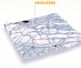 Places with similar names to Khvājehhā, Iran ::
Disclaimer :: Information on this page comes without warranty of any kind |
||
|
Where is Khvājehhā? Elevation and coordinates ::
Latitude (lat): 37°18'0"N Longitude (lon): 58°17'0"E
Elevation (approx.): 1229m (map arrows pan, magnifying glasses zoom) |
||
|
Visiting Khvājehhā? Hotel/Accommodation ::
Book a hotel in Khvājehhā Travel Guide ::
Buy a travel guide for Iran rental cars ::
car rental offers GPS waypoint ::
download a GPX waypoint (PoI) of Khvājehhā for your GPS receiver
|
||