|
search place name
|
||
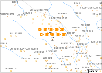
Khvosh Makān (Fārs, Iran)Khvosh Makān is a town in the Fārs region of Iran. An overview map of the region around Khvosh Makān is displayed below.
regional and 3d topo map of Khvosh Makān, Iran ::
Khvosh Makān airports ::
The nearest airport is SYZ - Shiraz Shahid Dastghaib Intl, located 97.2 km south east of Khvosh Makān.
Other airports nearby include BUZ - Bushehr (177.4 km south west), Nearby towns ::
Khvosh Makān (1.9km south east) //
Mambalūn (2.0km north west) //
Jowz-e Kangarī (2.3km north east) //
Jānī Verk (2.8km north) //
Ghūr ‘Alī Khān (3.0km south west) //
Ghūr-e ‘Alīkhān (3.1km south west) //
Gūmehr (3.3km south) //
Rūd Rezak (4.0km north) //
Cheshmeh-ye Sefīd (4.0km north) //
Dovezg (4.0km north) //
Gelūmehr (3.9km south east) //
Fārsījān (3.7km east) //
Bāghestān (4.6km north) //
Būrzak (4.5km north east) //
Dehgāh (4.7km north) //
Qanāt (5.3km north west) //
Chehel Cheshmeh (5.8km north) //
Rīshān (5.8km north east) //
Darreh Bīd (6.1km north) //
Bīd Moḩammadī (5.9km south east) //
Qal‘eh-ye Shahrīār (6.2km north) //
Deh Bozorg (6.3km south) //
Eshkerī (6.5km north) //
Bangestān (6.0km south east) //
Berghān (6.3km east) //
Mūrderāz (7.4km north) //
Sardābrūd (7.6km south west) //
Tang-e Kardūgī (8.2km north) //
Kharsor (8.3km north) //
[all distances 'as the bird flies' and approximate] 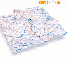 Places with similar names to Khvosh Makān, Iran ::
// Khvosh Makān (IR)
// Khvosh Makān (IR)
Disclaimer :: Information on this page comes without warranty of any kind |
||
|
Where is Khvosh Makān? Elevation and coordinates ::
Latitude (lat): 30°12'52"N Longitude (lon): 51°56'55"E
Elevation (approx.): 2211m (map arrows pan, magnifying glasses zoom) |
||
|
Visiting Khvosh Makān? Hotel/Accommodation ::
Book a hotel in Khvosh Makān Travel Guide ::
Buy a travel guide for Iran rental cars ::
car rental offers GPS waypoint ::
download a GPX waypoint (PoI) of Khvosh Makān for your GPS receiver
|
||