|
search place name
|
||
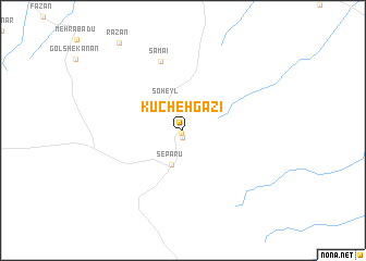
Kūcheh Gazī (Eşfahān, Iran)Kūcheh Gazī is a town in the Eşfahān region of Iran. An overview map of the region around Kūcheh Gazī is displayed below.
regional and 3d topo map of Kūcheh Gazī, Iran ::
Kūcheh Gazī airports ::
The nearest airport is AZD - Yazd Shahid Sadooghi, located 180.0 km south east of Kūcheh Gazī.
Nearby towns ::
 Places with similar names to Kūcheh Gazī, Iran ::
// Kuchuk Ass (UA)
// Kachikasy (RU)
// Kuchkas (RU)
// Guichixú (MX)
// Kashkasu (KG)
// Kashkasu (KG)
// Kūchek Zā'ī (IR)
// Caychax (FR)
// Cachagas (BO)
// Cuchicasi (BO)
Disclaimer :: Information on this page comes without warranty of any kind |
||
|
Where is Kūcheh Gazī? Elevation and coordinates ::
Latitude (lat): 33°8'20"N Longitude (lon): 53°1'56"E
Elevation (approx.): 1570m (map arrows pan, magnifying glasses zoom) |
||
|
Visiting Kūcheh Gazī? Hotel/Accommodation ::
Book a hotel in Kūcheh Gazī Travel Guide ::
Buy a travel guide for Iran rental cars ::
car rental offers GPS waypoint ::
download a GPX waypoint (PoI) of Kūcheh Gazī for your GPS receiver
|
||