|
search place name
|
||
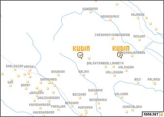
Kūdīn (Fārs, Iran)Kūdīn is a town in the Fārs region of Iran. An overview map of the region around Kūdīn is displayed below.
regional and 3d topo map of Kūdīn, Iran ::
Kūdīn airports ::
The nearest airport is SYZ - Shiraz Shahid Dastghaib Intl, located 101.5 km south east of Kūdīn.
Other airports nearby include BUZ - Bushehr (191.4 km south west), Nearby towns ::
Angareh (1.5km east) //
Sa‘lakī (3.8km south) //
Qal‘eh-ye ‘Abdollāh Beyk (5.0km east) //
Ardakān (6.0km south west) //
Shūl-e Bozorg (6.6km east) //
Cheshmeh-ye Āb-e Sarāb (7.6km north east) //
Kalleh Gāh (7.6km south east) //
Shesh Pīr (8.5km south) //
Rīshān (8.3km south west) //
Qal‘eh-ye Shahrīār (8.2km south west) //
Darreh Bīd (8.6km south west) //
Būrzak (9.6km south west) //
Dehgāh (9.7km south west) //
Sārān-e Pā'īn (10.5km north east) //
[all distances 'as the bird flies' and approximate] 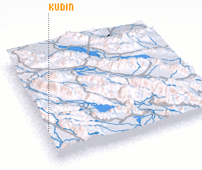 Places with similar names to Kūdīn, Iran ::
Disclaimer :: Information on this page comes without warranty of any kind |
||
|
Where is Kūdīn? Elevation and coordinates ::
Latitude (lat): 30°19'0"N Longitude (lon): 52°2'4"E
Elevation (approx.): 2544m (map arrows pan, magnifying glasses zoom) |
||
|
Visiting Kūdīn? Hotel/Accommodation ::
Book a hotel in Kūdīn Travel Guide ::
Buy a travel guide for Iran rental cars ::
car rental offers GPS waypoint ::
download a GPX waypoint (PoI) of Kūdīn for your GPS receiver
|
||