|
search place name
|
||
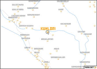
Kūh Lorī (Kermān, Iran)Kūh Lorī is a town in the Kermān region of Iran. An overview map of the region around Kūh Lorī is displayed below.
regional and 3d topo map of Kūh Lorī, Iran ::
Kūh Lorī airports ::
The nearest airport is KER - Kerman, located 150.0 km north west of Kūh Lorī.
Other airports nearby include BND - Bandar Abbass Intl (240.5 km south west), Nearby towns ::
Rīgābād (1.5km east) //
Bāgh-e Ja‘farī (2.6km south) //
Kahn-e Kamūn (6.0km north west) //
Madīn (6.9km south east) //
Sar Godār (7.1km south west) //
Bandar-e Zevork (7.5km south) //
Kechengān (6.8km north east) //
Dar Bā (7.8km south west) //
Sang Nevesht (8.4km north west) //
Darreh-ye Gorkī (7.9km west) //
Bajgī (8.6km south west) //
Shīn Gerā (7.9km west) //
Kahn-e Mo'men (9.3km south west) //
Gorbeh (9.3km south west) //
Dalfārd (9.2km south west) //
Delfārd (9.6km south west) //
Darvā (9.2km south west) //
[all distances 'as the bird flies' and approximate] 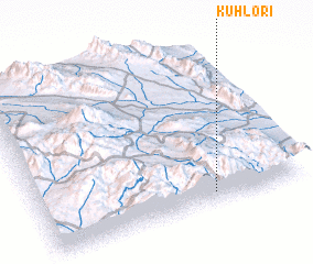 Places with similar names to Kūh Lorī, Iran ::
Disclaimer :: Information on this page comes without warranty of any kind |
||
|
Where is Kūh Lorī? Elevation and coordinates ::
Latitude (lat): 29°4'11"N Longitude (lon): 57°39'21"E
Elevation (approx.): 2972m (map arrows pan, magnifying glasses zoom) |
||
|
Visiting Kūh Lorī? Hotel/Accommodation ::
Book a hotel in Kūh Lorī Travel Guide ::
Buy a travel guide for Iran rental cars ::
car rental offers GPS waypoint ::
download a GPX waypoint (PoI) of Kūh Lorī for your GPS receiver
|
||