|
search place name
|
||
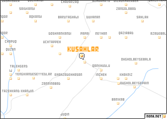
Kūsahlar (Iran)Kūsahlar is a town in Iran. An overview map of the region around Kūsahlar is displayed below.
regional and 3d topo map of Kūsahlar, Iran ::
Kūsahlar airports ::
The nearest airport is RAS - Rasht, located 144.5 km north east of Kūsahlar.
Other airports nearby include SDG - Sanandaj (184.3 km south west), Nearby towns ::
Qareh Seyyed (0.6km south east) //
Qārkhūdlū (4.0km south east) //
Pāpāʼī (5.0km north) //
Aḩmad Kandī (4.4km west) //
Emāmzādeh Ḩasan (5.1km south west) //
Īncheh (5.4km south east) //
Reyḩān (5.9km north east) //
Doshmān Kandī (6.5km north west) //
Bāyendar (6.9km north east) //
Ūch Tappeh (6.5km north west) //
Bāgh Kandī (7.5km south east) //
Dūvarān (8.9km north) //
Bārūt Āghājī (9.1km north) //
Chataz (8.3km south east) //
Zarrīnābād (8.6km south west) //
[all distances 'as the bird flies' and approximate]  Places with similar names to Kūsahlar, Iran ::
Disclaimer :: Information on this page comes without warranty of any kind |
||
|
Where is Kūsahlar? Elevation and coordinates ::
Latitude (lat): 36°29'19"N Longitude (lon): 48°21'50"E
Elevation (approx.): 1943m (map arrows pan, magnifying glasses zoom) |
||
|
Visiting Kūsahlar? Hotel/Accommodation ::
Book a hotel in Kūsahlar Travel Guide ::
Buy a travel guide for Iran rental cars ::
car rental offers GPS waypoint ::
download a GPX waypoint (PoI) of Kūsahlar for your GPS receiver
|
||