|
search place name
|
||
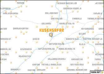
Kūseh Şafar (Ostān-e Āz̄arbāyjān-e Sharqī, Iran)Kūseh Şafar is a town in the Ostān-e Āz̄arbāyjān-e Sharqī region of Iran. An overview map of the region around Kūseh Şafar is displayed below.
regional and 3d topo map of Kūseh Şafar, Iran ::
Kūseh Şafar airports ::
The nearest airport is TBZ - Tabriz Intl, located 102.6 km north of Kūseh Şafar.
Other airports nearby include SDG - Sanandaj (225.2 km south), Nearby towns ::
Jamālābād (1.9km north) //
Sārī Qayeh (2.4km south west) //
Jamālābād (2.4km north west) //
Gūyjeh Qal‘eh-ye ‘Olyā (3.5km south east) //
Gūyjeh Qal‘eh-ye Soflá (3.5km south east) //
Qūyūn Qeshlāq (4.0km south) //
Golī Kand (4.0km north) //
Mavālū-ye Soflá (4.7km north east) //
Ūkhchī (4.8km south west) //
Gūyjeh Qamalāq (5.8km south) //
Sheykh Jān (5.8km north) //
Āqbolāgh-e Soflá (6.3km south east) //
Mavālū-ye ‘Olyā (5.8km north east) //
Āghjeh Kohel (5.8km north west) //
Mollā Qāsem (7.4km north) //
Sārī Qeshlāq-e ‘Olyā (6.2km east) //
Sārī Qeshlāq-e Soflá (6.2km east) //
Shakhtehlū (6.2km east) //
Āqbolāgh-e ‘Olyā (7.1km south east) //
Bolūkābād (7.1km north east) //
Moḩsenābād (7.0km north east) //
Qoţān (8.1km south west) //
Ganjī (8.1km south west) //
[all distances 'as the bird flies' and approximate] 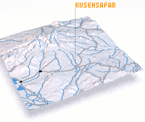 Places with similar names to Kūseh Şafar, Iran :: Disclaimer :: Information on this page comes without warranty of any kind |
||
|
Where is Kūseh Şafar? Elevation and coordinates ::
Latitude (lat): 37°14'0"N Longitude (lon): 46°30'0"E
Elevation (approx.): 1621m (map arrows pan, magnifying glasses zoom) |
||
|
Visiting Kūseh Şafar? Hotel/Accommodation ::
Book a hotel in Kūseh Şafar Travel Guide ::
Buy a travel guide for Iran rental cars ::
car rental offers GPS waypoint ::
download a GPX waypoint (PoI) of Kūseh Şafar for your GPS receiver
|
||