|
search place name
|
||
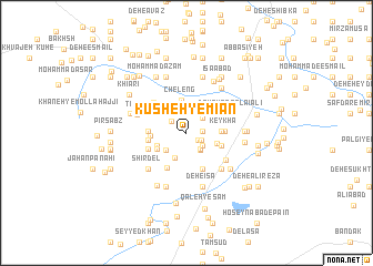
Kūsheh-ye Mīān (Sīstān va Balūchestān, Iran)Kūsheh-ye Mīān is a town in the Sīstān va Balūchestān region of Iran. An overview map of the region around Kūsheh-ye Mīān is displayed below.
regional and 3d topo map of Kūsheh-ye Mīān, Iran ::
Kūsheh-ye Mīān airports ::
The nearest airport is ZAH - Zahedan Intl, located 161.3 km south of Kūsheh-ye Mīān.
Nearby towns ::
Deh-e ‘Alī (1.3km south east) //
‘Eshqābād (1.4km south east) //
Deh Now (1.4km east) //
Sadakī (1.7km north west) //
Deh-e Khānī (1.9km south east) //
Ḩoseyn ‘Alīakbar (1.9km south east) //
Kūchek Zā'ī (2.0km south east) //
Qal‘eh-ye Ḩasan (2.0km north east) //
Karbalā'ī Yārmoḩammad (2.1km south east) //
Deh-e Reẕā (2.4km north east) //
Başīrān (2.5km south west) //
Başīrān (2.7km south west) //
‘Alī-ye Şūfī (2.6km north west) //
Khadrī (2.6km north west) //
Karbalā'ī ‘Abbās (2.6km north west) //
Deh Bāshī (2.6km north west) //
Deh-e Taqī (2.8km south west) //
Kūsheh-ye Pā'īn (2.9km east) //
Cheleng (3.4km north) //
Dowlatābād (3.0km south west) //
Moḩammad ‘Alī (3.0km east) //
Maḩmūdābād (3.0km east) //
Kūsheh-ye Bālā (3.0km east) //
Elāhī (3.1km west) //
Pol-e Asbī-ye Allāhābād (3.3km south east) //
Deh-e Karīm (3.4km north east) //
Keykhā (3.3km east) //
Ja‘farī (3.3km west) //
Mīr Beyk (3.3km west) //
[all distances 'as the bird flies' and approximate]  Places with similar names to Kūsheh-ye Mīān, Iran :: Disclaimer :: Information on this page comes without warranty of any kind |
||
|
Where is Kūsheh-ye Mīān? Elevation and coordinates ::
Latitude (lat): 30°51'56"N Longitude (lon): 61°24'6"E
Elevation (approx.): 478m (map arrows pan, magnifying glasses zoom) |
||
|
Visiting Kūsheh-ye Mīān? Hotel/Accommodation ::
Book a hotel in Kūsheh-ye Mīān Travel Guide ::
Buy a travel guide for Iran rental cars ::
car rental offers GPS waypoint ::
download a GPX waypoint (PoI) of Kūsheh-ye Mīān for your GPS receiver
|
||