|
search place name
|
||
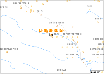
Lam-e Darvīsh (Lorestān, Iran)Lam-e Darvīsh is a town in the Lorestān region of Iran. An overview map of the region around Lam-e Darvīsh is displayed below.
regional and 3d topo map of Lam-e Darvīsh, Iran ::
Lam-e Darvīsh airports ::
The nearest airport is QMJ - Masjed Soleiman Shahid Asyaee, located 152.1 km south east of Lam-e Darvīsh.
Other airports nearby include KSH - Bakhtaran Shahid Ashrafi Esfahani (177.5 km north west), AWZ - Ahwaz (209.7 km south), Nearby towns ::
Pīrasad (NaNkm north) //
Teyk (1.6km east) //
Chenār (1.6km east) //
Khātūn (1.6km east) //
Kal Poleh (2.4km north west) //
Pākabūd (3.1km east) //
Sang Tarāshān (4.3km north) //
Dūsh Sorkh (4.8km south east) //
Āb Shīrīn-e Do (4.8km south east) //
Kolang Sar (4.7km east) //
Khalkāneh (4.7km east) //
Āb Shīrīn-e Yek (5.9km south east) //
Peyvasteh-ye Pā'īn (6.2km east) //
Ţīān (6.2km east) //
Sang Tarāshān (6.4km east) //
Peyvasteh-ye Bālā (7.2km north east) //
Mīnū ‘Olyā (7.2km south east) //
Mīnū Soflá (7.2km south east) //
Qalʼeh (8.8km north west) //
Tārān Keshvar (8.8km south east) //
Tāzān-e Soflá (9.7km south east) //
Tāzān-e ‘Olyā (9.7km south east) //
[all distances 'as the bird flies' and approximate] 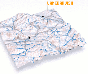 Places with similar names to Lam-e Darvīsh, Iran :: Disclaimer :: Information on this page comes without warranty of any kind |
||
|
Where is Lam-e Darvīsh? Elevation and coordinates ::
Latitude (lat): 33°13'0"N Longitude (lon): 48°31'0"E
Elevation (approx.): 1720m (map arrows pan, magnifying glasses zoom) |
||
|
Visiting Lam-e Darvīsh? Hotel/Accommodation ::
Book a hotel in Lam-e Darvīsh Travel Guide ::
Buy a travel guide for Iran rental cars ::
car rental offers GPS waypoint ::
download a GPX waypoint (PoI) of Lam-e Darvīsh for your GPS receiver
|
||