|
search place name
|
||
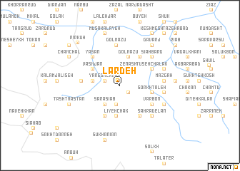
Lardeh (Gīlān, Iran)Lardeh is a town in the Gīlān region of Iran. An overview map of the region around Lardeh is displayed below.
regional and 3d topo map of Lardeh, Iran ::
Lardeh airports ::
The nearest airport is RZR - Ramsar, located 55.3 km east of Lardeh.
Other airports nearby include RAS - Rasht (76.0 km north west), THR - Teheran Mehrabad Intl (162.1 km south east), Nearby towns ::
Haft Band (1.6km south east) //
Yareshlamān (2.0km west) //
Zenash (2.8km north east) //
Gīlāsh (3.0km south) //
Lūā'ī (3.2km north west) //
Kārsang (3.6km south west) //
Sarāsīāb (3.6km south west) //
Pīshkījān (3.5km west) //
Golmāzū (4.5km north) //
Līyeh Chāk (4.9km south) //
Vasmjān (4.3km north west) //
Sorkh Taleh (4.2km east) //
Komonī (5.2km south) //
Kolām Rūd (5.1km north east) //
Tūseh Chālak (4.8km north east) //
Peynavand (4.8km north east) //
Kūlchā Sar (5.5km south east) //
Varbon (5.0km south east) //
Īnī (5.0km south east) //
Yasan (5.6km north west) //
Jalīseh (4.9km west) //
Golmāzū (6.3km north) //
Bāzān (6.0km north east) //
Sīāhbarg (6.0km north east) //
Māzgāh (5.6km east) //
Banān (5.6km east) //
Şaḩrādelān (6.3km south east) //
Do Āb (6.1km north east) //
Kalām Īnī (6.3km south east) //
[all distances 'as the bird flies' and approximate] 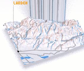 Places with similar names to Lardeh, Iran ::
Disclaimer :: Information on this page comes without warranty of any kind |
||
|
Where is Lardeh? Elevation and coordinates ::
Latitude (lat): 36°45'37"N Longitude (lon): 50°5'17"E
Elevation (approx.): 1839m (map arrows pan, magnifying glasses zoom) |
||
|
Visiting Lardeh? Hotel/Accommodation ::
Book a hotel in Lardeh Travel Guide ::
Buy a travel guide for Iran rental cars ::
car rental offers GPS waypoint ::
download a GPX waypoint (PoI) of Lardeh for your GPS receiver
|
||