|
search place name
|
||
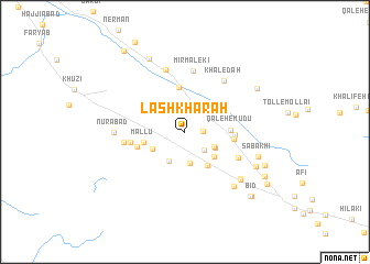
Lashkharah (Fārs, Iran)Lashkharah is a town in the Fārs region of Iran. An overview map of the region around Lashkharah is displayed below.
regional and 3d topo map of Lashkharah, Iran ::
Lashkharah airports ::
The nearest airport is KIH - Kish Island, located 133.0 km south east of Lashkharah.
Other airports nearby include BDH - Bandar Lengeh (199.3 km south east), Nearby towns ::
Qal‘eh-e Kamāl (1.6km east) //
Kachahlā (2.5km south east) //
Tormān (3.2km south) //
Qal‘eh-e ‘Alī Bābā (3.0km south east) //
Leshkān (3.2km south west) //
Āb Shūlī (3.1km south east) //
Chāh-e Gazī (3.4km south west) //
Berkeh-ye Māh Bānū (3.7km south east) //
Nāvbandī (4.0km south east) //
Mallū (3.9km west) //
Narmtin (4.6km north) //
Qal‘eh-e Mūdū (4.1km east) //
Qal‘eh-e Ḩājjī Mohammad (4.4km east) //
Choghūhā (4.5km east) //
Tang-e Termān (4.6km west) //
Toll-e Mallū (5.1km west) //
Qal‘eh-e Sardār (5.5km south east) //
Ḩowzī (5.6km west) //
Mīr Malekī (6.3km north) //
Khāledah (6.3km north east) //
Varāvī (6.6km north) //
Nūrābād (6.4km west) //
Zanganeh (6.9km south east) //
Qal‘eh-e Moz̧affar (7.0km south east) //
Kahūr Sūkhteh (7.1km south east) //
Sabakhī (7.0km east) //
Gholām ‘Abdollāhī (7.3km south east) //
Gerehn-e ‘Arabī (8.2km north west) //
Chāh-e Sharaf (7.8km north east) //
[all distances 'as the bird flies' and approximate]  Places with similar names to Lashkharah, Iran :: Disclaimer :: Information on this page comes without warranty of any kind |
||
|
Where is Lashkharah? Elevation and coordinates ::
Latitude (lat): 27°24'33"N Longitude (lon): 53°4'20"E
Elevation (approx.): 418m (map arrows pan, magnifying glasses zoom) |
||
|
Visiting Lashkharah? Hotel/Accommodation ::
Book a hotel in Lashkharah Travel Guide ::
Buy a travel guide for Iran rental cars ::
car rental offers GPS waypoint ::
download a GPX waypoint (PoI) of Lashkharah for your GPS receiver
|
||