|
search place name
|
||
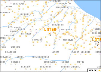
Lāteh (Gīlān, Iran)Lāteh is a town in the Gīlān region of Iran. An overview map of the region around Lāteh is displayed below.
regional and 3d topo map of Lāteh, Iran ::
Lāteh airports ::
The nearest airport is RZR - Ramsar, located 43.8 km east of Lāteh.
Other airports nearby include RAS - Rasht (62.5 km north west), THR - Teheran Mehrabad Intl (179.8 km south east), Nearby towns ::
Esmā‘īl Gavābar-e ‘Olyā (1.7km north east) //
Esmā‘īl Gavābar-e Soflá (1.5km west) //
Darzī Govābar (1.7km north east) //
Shabkhūs Sarā (1.7km east) //
Shabkhūsalāt (1.7km east) //
Halū Sarā-ye Bālā (1.8km south east) //
Garkūrūd (2.3km south east) //
Tāzehābād-e Āsīāb Sarā (2.6km north) //
‘Alīābād-e Rameshāyeh (2.6km north) //
Goshkūr (2.5km south west) //
Pīl Darreh (2.7km north west) //
Kash Kalāyeh (3.1km north) //
Lāt Sarā (3.0km north east) //
Gūsht Pazān (2.7km south east) //
Varkūrā (3.3km south) //
Rūd Gavāber (3.3km south) //
Jīr Gavābar (2.8km west) //
Golestān Sarā (3.4km south east) //
Halū Sarā-ye Pā'īn (2.9km east) //
Ābdangsar-e Lātleyl (3.6km north) //
Lalīj Gavāber (3.0km east) //
Sūkhteh Kesh (3.3km north east) //
Posht Darreh Lengeh (3.7km south) //
Jowrkā Sar (3.7km north west) //
Sīāh Marz-e Gavābar (3.6km north west) //
Būz Gūr (3.6km south west) //
Sopordān (3.9km north east) //
Kohneh Gūyeh (3.5km east) //
Sūr Shafīlāt (4.0km north east) //
[all distances 'as the bird flies' and approximate]  Places with similar names to Lāteh, Iran ::
Disclaimer :: Information on this page comes without warranty of any kind |
||
|
Where is Lāteh? Elevation and coordinates ::
Latitude (lat): 37°2'41"N Longitude (lon): 50°13'0"E
Elevation (approx.): 178m (map arrows pan, magnifying glasses zoom) |
||
|
Visiting Lāteh? Hotel/Accommodation ::
Book a hotel in Lāteh Travel Guide ::
Buy a travel guide for Iran rental cars ::
car rental offers GPS waypoint ::
download a GPX waypoint (PoI) of Lāteh for your GPS receiver
|
||