|
search place name
|
||
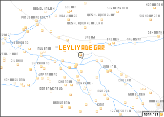
Leylī Yādegār (Hamadān, Iran)Leylī Yādegār is a town in the Hamadān region of Iran. An overview map of the region around Leylī Yādegār is displayed below.
regional and 3d topo map of Leylī Yādegār, Iran ::
Leylī Yādegār airports ::
The nearest airport is KSH - Bakhtaran Shahid Ashrafi Esfahani, located 97.0 km west of Leylī Yādegār.
Other airports nearby include SDG - Sanandaj (153.0 km north west), Nearby towns ::
Amīnābād (1.7km south west) //
‘Alīābād (2.2km south west) //
Līlān (2.9km south) //
Gūsheh-ye Sa‘d-e Vaqqāş (2.9km east) //
Akbarābād (3.2km south west) //
Bālā Jūb (4.2km south) //
Ḩabībābād (3.7km north west) //
Mo‘tamedābād (3.6km west) //
Vasaj (4.2km north) //
Gūsheh Sa‘d-e Vaqqāş (3.7km east) //
Bālā Jūb (4.9km south) //
Ja‘farābād-e Pāʼīn (4.6km south west) //
Kahrīz-e Şalāḩ od Dīn (5.0km north west) //
‘Anbar Qanbar (5.1km south east) //
Leylās (5.4km south west) //
Bāqerābād (5.1km north east) //
Shahrak (5.1km west) //
Dowrāneh (6.5km south) //
Valīsīrāb (6.4km south) //
‘Alamdār (5.6km south east) //
Vahmān (6.0km south east) //
Mūsáābād (5.8km west) //
Qeshlāq-e Valīollāh (7.0km north) //
‘Asgarābād (7.1km south) //
Mīāngarān (6.2km north east) //
Fīrūzābād (6.2km north east) //
Chenārī (6.9km south west) //
Kahrīz-e Salīm (6.6km north west) //
Band Amān (7.3km south) //
[all distances 'as the bird flies' and approximate] 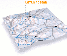 Places with similar names to Leylī Yādegār, Iran :: Disclaimer :: Information on this page comes without warranty of any kind |
||
|
Where is Leylī Yādegār? Elevation and coordinates ::
Latitude (lat): 34°17'13"N Longitude (lon): 48°12'36"E
Elevation (approx.): 1502m (map arrows pan, magnifying glasses zoom) |
||
|
Visiting Leylī Yādegār? Hotel/Accommodation ::
Book a hotel in Leylī Yādegār Travel Guide ::
Buy a travel guide for Iran rental cars ::
car rental offers GPS waypoint ::
download a GPX waypoint (PoI) of Leylī Yādegār for your GPS receiver
|
||