|
search place name
|
||
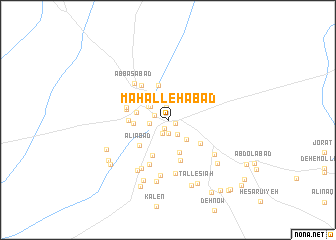
Maḩallehābād (Kermān, Iran)Maḩallehābād is a town in the Kermān region of Iran. An overview map of the region around Maḩallehābād is displayed below.
regional and 3d topo map of Maḩallehābād, Iran ::
Maḩallehābād airports ::
The nearest airport is KER - Kerman, located 176.6 km east of Maḩallehābād.
Other airports nearby include AZD - Yazd Shahid Sadooghi (214.3 km north), Nearby towns ::
Qoţbābād (0.8km south east) //
Shahr-e Bābak (1.0km south) //
Lamjerd (1.4km north) //
Ḩasanābād (1.5km south) //
Hāveshk (1.4km west) //
Gowd Gaz (1.6km south) //
Deh Shādū'īyeh (1.9km south east) //
Dehū (1.8km west) //
Hāveshk (2.2km north west) //
Shūrū (2.4km north west) //
Lālehzār (2.8km south east) //
Pīrjel (3.2km north west) //
Mūrū'īyeh (3.1km west) //
Sharīkābād (3.8km south) //
Deh Mūsá (3.3km west) //
Moz̧affarābād (3.9km north) //
‘Alīābād (4.0km south west) //
Dangreh (4.2km south) //
Deh-e Ḩoseynābād (3.8km west) //
Moḩammadābād-e Khān (4.1km south east) //
Deh Now (4.6km south) //
Behzād Farrokh (4.1km west) //
Khātūn (4.6km north west) //
Esmā‘īlābād (4.3km west) //
Khorsand (4.5km north west) //
Qanāt ol Nūj (4.6km north west) //
Kamālī (5.3km south) //
Ja‘farābād (4.9km north west) //
‘Abbāsābād (5.2km north west) //
[all distances 'as the bird flies' and approximate] 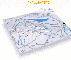 Places with similar names to Maḩallehābād, Iran :: Disclaimer :: Information on this page comes without warranty of any kind |
||
|
Where is Maḩallehābād? Elevation and coordinates ::
Latitude (lat): 30°6'57"N Longitude (lon): 55°7'34"E
Elevation (approx.): 1851m (map arrows pan, magnifying glasses zoom) |
||
|
Visiting Maḩallehābād? Hotel/Accommodation ::
Book a hotel in Maḩallehābād Travel Guide ::
Buy a travel guide for Iran rental cars ::
car rental offers GPS waypoint ::
download a GPX waypoint (PoI) of Maḩallehābād for your GPS receiver
|
||