|
search place name
|
||
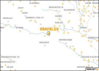
Mahvaleh (Lorestān, Iran)Mahvaleh is a town in the Lorestān region of Iran. An overview map of the region around Mahvaleh is displayed below.
regional and 3d topo map of Mahvaleh, Iran ::
Mahvaleh airports ::
The nearest airport is KSH - Bakhtaran Shahid Ashrafi Esfahani, located 110.4 km north west of Mahvaleh.
Other airports nearby include SDG - Sanandaj (195.4 km north west), QMJ - Masjed Soleiman Shahid Asyaee (221.0 km south east), Nearby towns ::
Cham-e Dagal (0.7km north west) //
Cham Takleh-ye ‘Olyā (1.2km north west) //
Mahvaleh-ye ‘Olyā (1.9km north) //
Cham Takleh (1.5km west) //
Cheshmeh-ye Shāh Qolī (3.1km north east) //
Ḩaskūhān (4.0km south west) //
Mīsūleh (4.0km north east) //
Mīvaleh (4.8km north east) //
Cham Darreh (4.8km north east) //
Bard Bal (5.1km north west) //
Varnamad (4.7km east) //
Hamvar-e Kūlīvand (5.0km east) //
Cham-e Kāshī (5.3km north east) //
Darreh Bāgh-e Soflá (5.9km north east) //
Sarāb-e Saqqā (5.9km south east) //
Bīd Qaţār (5.9km east) //
Bīd Qaţār-e ‘Olyā (5.9km east) //
Zhīrīān (6.9km north east) //
Qanbar ‘Alī-ye Soflá (6.7km north west) //
Sarāb Chenār (6.7km south east) //
Cheshmeh Karīm (7.2km north west) //
Qanbar‘alī-ye ‘Olyā (7.2km north west) //
Darreh Bāgh-e ‘Olyā (7.8km north east) //
Dārmāhī (7.8km south east) //
Sarāb-e Dorīshdār (8.1km north west) //
Serenjeh-ye Doāb (7.8km north east) //
Dār Dīdehbān (8.3km north west) //
Darreh Bāgh-e ‘Olyā (8.3km north east) //
Eslāmābād (10.6km north east) //
[all distances 'as the bird flies' and approximate]  Places with similar names to Mahvaleh, Iran ::
Disclaimer :: Information on this page comes without warranty of any kind |
||
|
Where is Mahvaleh? Elevation and coordinates ::
Latitude (lat): 33°44'0"N Longitude (lon): 48°6'0"E
Elevation (approx.): 1644m (map arrows pan, magnifying glasses zoom) |
||
|
Visiting Mahvaleh? Hotel/Accommodation ::
Book a hotel in Mahvaleh Travel Guide ::
Buy a travel guide for Iran rental cars ::
car rental offers GPS waypoint ::
download a GPX waypoint (PoI) of Mahvaleh for your GPS receiver
|
||