|
search place name
|
||
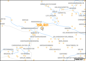
Malāvī (Lorestān, Iran)Malāvī is a town in the Lorestān region of Iran. An overview map of the region around Malāvī is displayed below.
regional and 3d topo map of Malāvī, Iran ::
Malāvī airports ::
The nearest airport is KSH - Bakhtaran Shahid Ashrafi Esfahani, located 135.8 km north west of Malāvī.
Other airports nearby include QMJ - Masjed Soleiman Shahid Asyaee (196.1 km south east), AWZ - Ahwaz (230.0 km south east), Nearby towns ::
Teymūrābād (2.6km north west) //
Kolīvand (2.6km north west) //
Mūrānī (2.7km north west) //
Gol Gol-e Soflá (2.7km west) //
Bābā Zeyd (3.6km south west) //
Parān Parvīz (3.8km north west) //
Takht Shīr-e Vāshīān (4.1km south west) //
Khersdar-e ‘Olyā (3.8km south west) //
Vareh Zard-e Khersdar (4.1km south west) //
Gol Gol-e Vasaţī (4.6km south east) //
Chāh Shīrīn-e Vāshīān (5.4km south east) //
Garāb-e Parān Parvīz (4.9km west) //
Vāshīān-e Naşīr Tappeh (5.9km south east) //
Gol Gol-e ‘Olyā (5.7km south east) //
Rūband-e Jolgeh-ye Khalaj (5.7km north east) //
Leylān Cham (6.3km north east) //
Khersdar-e Soflá (6.2km south west) //
Harshīr-e ‘Abbāsī (7.5km south) //
Harshīr-e Īmānī (7.5km south) //
Cheshmeh Gosh (7.6km south) //
Bāgh-e Gol Gol (6.8km south east) //
Jolgeh-ye Khalaj-e ‘Olyā (6.9km north east) //
Khersdar-e Kākāmorād (7.4km south west) //
Sheykh Morād (7.9km south) //
Jolgeh-ye Khalaj-e Soflá (7.4km north east) //
Sar Kūh (7.5km north west) //
Gardangāh-e Shāh‘alī (8.1km south east) //
Barāftāb (8.6km north east) //
Kalāt (8.6km north east) //
[all distances 'as the bird flies' and approximate]  Places with similar names to Malāvī, Iran ::
Disclaimer :: Information on this page comes without warranty of any kind |
||
|
Where is Malāvī? Elevation and coordinates ::
Latitude (lat): 33°13'59"N Longitude (lon): 47°46'11"E
Elevation (approx.): 1272m (map arrows pan, magnifying glasses zoom) |
||
|
Visiting Malāvī? Hotel/Accommodation ::
Book a hotel in Malāvī Travel Guide ::
Buy a travel guide for Iran rental cars ::
car rental offers GPS waypoint ::
download a GPX waypoint (PoI) of Malāvī for your GPS receiver
|
||