|
search place name
|
||
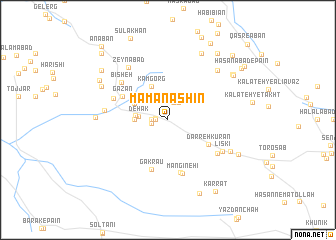
Māma Nashīn (Iran)Māma Nashīn is a town in Iran. An overview map of the region around Māma Nashīn is displayed below.
regional and 3d topo map of Māma Nashīn, Iran ::
Māma Nashīn airports ::
The nearest airport is XBJ - Birjand, located 83.6 km north of Māma Nashīn.
Nearby towns ::
Kalāteh-ye Mazār (1.2km west) //
Dowrūdī (1.2km west) //
Zīārat (1.6km west) //
Ḩoseynābād (1.6km west) //
Sāyeh Sangān (1.6km west) //
Būrī (2.0km north) //
Khosravī (2.1km north) //
Ḩasanābād (2.2km north east) //
Dehak (2.8km west) //
Mollā Raḩīm (3.1km west) //
Gol-e Khār (3.1km west) //
Ganj-e Now (3.6km north west) //
Kam Gorg (4.0km north west) //
Darreh-ye Kūrān (4.6km south east) //
Darreh Kūrān (4.6km south east) //
Gazān (5.0km north west) //
Gakrāu (5.8km south) //
Ḩasanābād-e Korq-e Sang (6.0km south) //
Kūchūleh Mangīneh'ī (6.1km south) //
Mangīneh'ī (6.2km south) //
Regrān (5.7km north west) //
Bīsheh (6.1km north west) //
Ḩoseynābād (6.0km south east) //
Līskī (6.2km south east) //
Sangān-e Pā'īn (6.1km west) //
Zeynābād (7.0km north west) //
Ḩoseynābād-e Būrgān (6.9km south east) //
Ḩasanābād Soflá (7.3km north east) //
Qīāsābād (6.9km west) //
[all distances 'as the bird flies' and approximate] 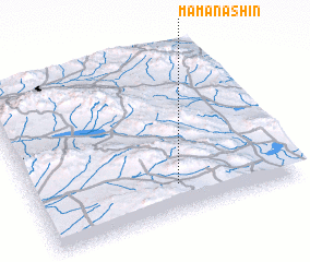 Places with similar names to Māma Nashīn, Iran :: Disclaimer :: Information on this page comes without warranty of any kind |
||
|
Where is Māma Nashīn? Elevation and coordinates ::
Latitude (lat): 32°11'0"N Longitude (lon): 59°33'0"E
Elevation (approx.): 2019m (map arrows pan, magnifying glasses zoom) |
||
|
Visiting Māma Nashīn? Hotel/Accommodation ::
Book a hotel in Māma Nashīn Travel Guide ::
Buy a travel guide for Iran rental cars ::
car rental offers GPS waypoint ::
download a GPX waypoint (PoI) of Māma Nashīn for your GPS receiver
|
||