|
search place name
|
||
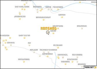
Manshād (Yazd, Iran)Manshād is a town in the Yazd region of Iran. An overview map of the region around Manshād is displayed below.
regional and 3d topo map of Manshād, Iran ::
Manshād airports ::
The nearest airport is AZD - Yazd Shahid Sadooghi, located 42.1 km north of Manshād.
Other airports nearby include SYZ - Shiraz Shahid Dastghaib Intl (270.2 km south west), Nearby towns ::
Gavar (1.6km east) //
Gāv Afshād (3.9km north east) //
Banādak-e Sādāt (6.0km north) //
Reẕā Khān (5.9km south east) //
Mazra‘eh-ye Khāneh (6.9km south) //
Sang-e Derāz (7.1km south) //
Darb-e Bāgh (8.5km south) //
Nīr (7.6km south west) //
Darreh (8.1km north east) //
Panj Dar (8.4km south west) //
Chāhūk (8.8km south) //
Bāgh Mīān (9.3km south) //
Tezerjān (9.5km north) //
Darreh Gel (9.9km south east) //
Darreh Arzanī (10.0km south east) //
[all distances 'as the bird flies' and approximate] 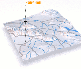 Places with similar names to Manshād, Iran ::
Disclaimer :: Information on this page comes without warranty of any kind |
||
|
Where is Manshād? Elevation and coordinates ::
Latitude (lat): 31°31'43"N Longitude (lon): 54°13'1"E
Elevation (approx.): 2273m (map arrows pan, magnifying glasses zoom) |
||
|
Visiting Manshād? Hotel/Accommodation ::
Book a hotel in Manshād Travel Guide ::
Buy a travel guide for Iran rental cars ::
car rental offers GPS waypoint ::
download a GPX waypoint (PoI) of Manshād for your GPS receiver
|
||