|
search place name
|
||
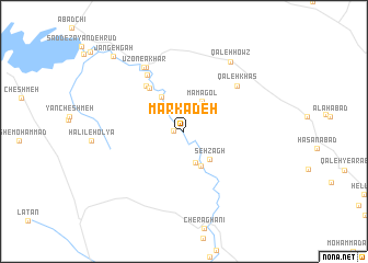
Mārkadeh (Chahār Maḩāll va Bakhtīār, Iran)Mārkadeh is a town in the Chahār Maḩāll va Bakhtīār region of Iran. An overview map of the region around Mārkadeh is displayed below.
regional and 3d topo map of Mārkadeh, Iran ::
Mārkadeh airports ::
The nearest airport is QMJ - Masjed Soleiman Shahid Asyaee, located 164.2 km south west of Mārkadeh.
Nearby towns ::
Qūchān (0.9km west) //
Şādeqābād (3.4km south) //
Māmāgol (3.4km north east) //
Seh Zāgh (3.6km south east) //
Yāseh Chāh (3.8km south east) //
Garmdarreh (4.0km north west) //
Qarāqūsh (5.3km north west) //
Deh Khān (5.7km north west) //
Darkān (6.5km north west) //
Qal‘eh Khās (6.5km north east) //
Ḩojjatābād (7.3km north west) //
Ūzon-e Ākhār (7.3km north west) //
Qal‘eh Ḩowẕ (8.2km north east) //
Jangehgāh (9.8km north west) //
[all distances 'as the bird flies' and approximate] 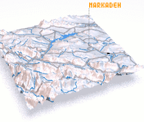 Places with similar names to Mārkadeh, Iran ::
Disclaimer :: Information on this page comes without warranty of any kind |
||
|
Where is Mārkadeh? Elevation and coordinates ::
Latitude (lat): 32°39'29"N Longitude (lon): 50°50'4"E
Elevation (approx.): 2092m (map arrows pan, magnifying glasses zoom) |
||
|
Visiting Mārkadeh? Hotel/Accommodation ::
Book a hotel in Mārkadeh Travel Guide ::
Buy a travel guide for Iran rental cars ::
car rental offers GPS waypoint ::
download a GPX waypoint (PoI) of Mārkadeh for your GPS receiver
|
||