|
search place name
|
||
Maskūpā (Iran)Maskūpā is a town in Iran. An overview map of the region around Maskūpā is displayed below.
regional and 3d topo map of Maskūpā, Iran ::
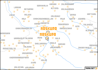
Nearby towns ::
Korasb (1.5km south east) //
Maskūpā (2.2km south) //
Mūlā (3.4km south east) //
Varmatnī (3.9km north) //
Perā (3.4km south west) //
Tājrāst (3.9km north west) //
Mowlā (4.2km south) //
Astār Shesh (3.6km north west) //
Kor Chāh (4.4km south west) //
Emāmzādeh ‘Alī Farīm (4.4km south west) //
Aḩmadābād (4.1km west) //
Shel Darreh (4.9km south west) //
Konīm (5.3km north) //
Parvarījābād (5.4km north) //
Angefām (5.1km south east) //
Karbā (5.0km north west) //
Emāmzādeh ‘Abdollāh (5.6km north) //
‘Alīābād (6.0km south) //
Ja‘farābād (5.9km south) //
Dīneh Sar (6.3km south) //
Now Kandeh (5.5km north east) //
Āboksar (6.0km north west) //
Sar Kām (5.9km south east) //
Narges Zamīn (5.4km east) //
Valāghūz (6.6km north) //
Kohneh Deh (6.7km south west) //
Moḩammadābād (6.2km south west) //
Pāchā (6.7km north east) //
Pājā (6.7km north east) //
[all distances 'as the bird flies' and approximate] 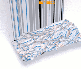 Places with similar names to Maskūpā, Iran ::
Disclaimer :: Information on this page comes without warranty of any kind |
||
|
Where is Maskūpā? Elevation and coordinates ::
Latitude (lat): 36°13'9"N Longitude (lon): 53°19'12"E
Elevation (approx.): 1039m (map arrows pan, magnifying glasses zoom) |
||
|
Visiting Maskūpā? Hotel/Accommodation ::
Book a hotel in Maskūpā Travel Guide ::
Buy a travel guide for Iran rental cars ::
car rental offers GPS waypoint ::
download a GPX waypoint (PoI) of Maskūpā for your GPS receiver
|
||