|
search place name
|
||
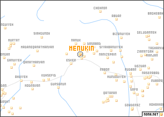
Menūkīn (Kermān, Iran)Menūkīn is a town in the Kermān region of Iran. An overview map of the region around Menūkīn is displayed below.
regional and 3d topo map of Menūkīn, Iran ::
Menūkīn airports ::
The nearest airport is KER - Kerman, located 106.1 km north of Menūkīn.
Nearby towns ::
Tezerj (0.0km north) //
Nanīz-e Bālā (0.7km north east) //
Dārenjān (0.9km north) //
Darreh Mūn (1.9km north east) //
Deh Dīvān (2.4km north west) //
Esker (2.5km south west) //
Bīghamābād (2.9km north west) //
Mobārakeh (2.7km north east) //
Bīd Zanān (3.3km north) //
Nanūk (3.5km north) //
‘Eshqābād (3.2km west) //
Dāsābād (3.5km north east) //
Kabīr (3.5km north east) //
Nanīz-e Pā'īn (5.1km east) //
Rābor (5.7km south east) //
Sīyah Banū'īyeh (6.1km east) //
Zamīnanjīr (6.4km east) //
Gūr Sārūn (8.2km south west) //
Koshkū'īyeh (7.8km south east) //
Gonjān (7.9km east) //
Kūh Sefīd (8.2km south west) //
Mūrūdū'īyeh (8.5km south east) //
Kalmūsht (9.1km south west) //
Qaţārān (10.4km south east) //
Langar (10.6km south east) //
Ābdar (11.3km north east) //
[all distances 'as the bird flies' and approximate] 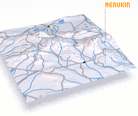 Places with similar names to Menūkīn, Iran ::
Disclaimer :: Information on this page comes without warranty of any kind |
||
|
Where is Menūkīn? Elevation and coordinates ::
Latitude (lat): 29°19'13"N Longitude (lon): 56°51'43"E
Elevation (approx.): 2511m (map arrows pan, magnifying glasses zoom) |
||
|
Visiting Menūkīn? Hotel/Accommodation ::
Book a hotel in Menūkīn Travel Guide ::
Buy a travel guide for Iran rental cars ::
car rental offers GPS waypoint ::
download a GPX waypoint (PoI) of Menūkīn for your GPS receiver
|
||