|
search place name
|
||
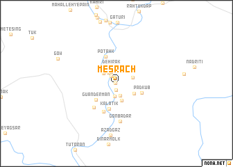
Mesrach (Sīstān va Balūchestān, Iran)Mesrach is a town in the Sīstān va Balūchestān region of Iran. An overview map of the region around Mesrach is displayed below.
regional and 3d topo map of Mesrach, Iran ::
Mesrach airports ::
The nearest airport is ZBR - Chah Bahar, located 117.8 km south of Mesrach.
Other airports nearby include GWD - Gwadar (208.7 km south east), Nearby towns ::
Mīsh (0.2km west) //
Kahīr-e Nīk (1.1km south) //
Pādīn (1.4km north west) //
Kheyr Morād (1.9km north west) //
Mīrābād (2.1km south) //
Karūchī (2.1km south) //
Karkūm (2.1km north west) //
Mīrch (2.5km north west) //
Dehīrak (2.8km north) //
Sorkh Barg (2.8km south) //
Dīvārī (2.6km north east) //
Qarah Qom (3.0km north west) //
Garrūtak (3.0km south east) //
Gūandermān (4.0km south west) //
Kalātīk (4.2km south) //
Pādkūb (4.0km east) //
Potahk (4.6km north) //
Madīg (4.9km south west) //
Dashtūk (5.0km south west) //
Gonbadār (6.1km south) //
Āzād Gaz (8.3km south) //
[all distances 'as the bird flies' and approximate] 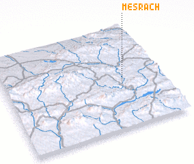 Places with similar names to Mesrach, Iran ::
// Meiserich (DE)
// Mooseurach (DE)
// Mesorráchi (GR)
// Messarosh (UA)
// Māsarāsh (IR)
// Mazār Shāh (IR)
// Misri Shāh (PK)
// Mzarcha (MA)
// Mzarcha (MA)
// Masarach (ES)
Disclaimer :: Information on this page comes without warranty of any kind |
||
|
Where is Mesrach? Elevation and coordinates ::
Latitude (lat): 26°27'17"N Longitude (lon): 60°44'40"E
Elevation (approx.): 813m (map arrows pan, magnifying glasses zoom) |
||
|
Visiting Mesrach? Hotel/Accommodation ::
Book a hotel in Mesrach Travel Guide ::
Buy a travel guide for Iran rental cars ::
car rental offers GPS waypoint ::
download a GPX waypoint (PoI) of Mesrach for your GPS receiver
|
||