|
search place name
|
||
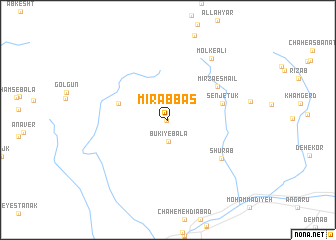
Mīr ‘Abbās (Iran)Mīr ‘Abbās is a town in Iran. An overview map of the region around Mīr ‘Abbās is displayed below.
regional and 3d topo map of Mīr ‘Abbās, Iran ::
Mīr ‘Abbās airports ::
The nearest airport is XBJ - Birjand, located 32.0 km east of Mīr ‘Abbās.
Nearby towns ::
Būkī-ye Pā'īn (0.1km west) //
Būkī-ye Bālā (2.3km south) //
Khākestarān (5.0km west) //
Senjetūk (5.4km east) //
Mīrzā Esmā‘īl (6.0km north east) //
Shūr Āb (6.6km south east) //
Molk-e ‘Alī (8.0km north east) //
[all distances 'as the bird flies' and approximate] 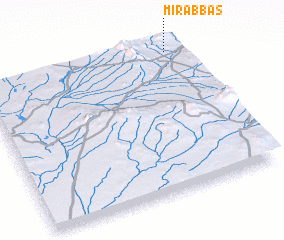 Places with similar names to Mīr ‘Abbās, Iran ::
// Marobozy (MG)
// Morobasso (BF)
// Mihrābzai (PK)
// Mīrbāz (PK)
// Mīr Bāzi (PK)
// Murabuesse (MZ)
// Morbus (SO)
// Maurubiassa (TP)
// Maurubiassa (TP)
// Marboz (FR)
Disclaimer :: Information on this page comes without warranty of any kind |
||
|
Where is Mīr ‘Abbās? Elevation and coordinates ::
Latitude (lat): 32°58'0"N Longitude (lon): 58°56'0"E
Elevation (approx.): 1729m (map arrows pan, magnifying glasses zoom) |
||
|
Visiting Mīr ‘Abbās? Hotel/Accommodation ::
Book a hotel in Mīr ‘Abbās Travel Guide ::
Buy a travel guide for Iran rental cars ::
car rental offers GPS waypoint ::
download a GPX waypoint (PoI) of Mīr ‘Abbās for your GPS receiver
|
||