|
search place name
|
||
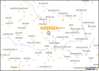
Mīr Qāsem (Iran)Mīr Qāsem is a town in Iran. An overview map of the region around Mīr Qāsem is displayed below.
regional and 3d topo map of Mīr Qāsem, Iran ::
Mīr Qāsem airports ::
The nearest airport is QMJ - Masjed Soleiman Shahid Asyaee, located 186.4 km south of Mīr Qāsem.
Nearby towns ::
Chenārestān (1.2km south west) //
Lūzdar-e Vosţá (1.1km east) //
Kohneh Ḩeşār (1.9km south) //
Khalīfeh Bolāghī (1.9km north) //
Cham-e Raḩīm (1.9km north) //
Fezyāneh-ye Soflá (1.9km south west) //
Nez̧āmābād (2.3km south east) //
Fezāneh-ye Bālā (2.6km north west) //
Lūz-e Vosţá (3.3km north east) //
Lūzdar-e ‘Olyā (3.3km north east) //
Lowzdar-e Vasaţī (3.4km north east) //
Ḩasanābād (4.0km south) //
Fāghelū (4.0km north west) //
Do Āb (5.0km south) //
Deh Zamān (5.1km north) //
Baramābād (5.2km north) //
Deh-e Salmān (4.4km east) //
Kamāl Şāleḩ (5.3km south) //
Kachalū (5.6km north) //
Qeshlāq (5.9km north) //
Deh-e Naşīr (5.8km south) //
Qal‘eh Now (5.9km south) //
Gazţāf-e ‘Olyā (5.3km west) //
Meşrlū (5.7km west) //
Malḩamdar (6.6km south west) //
Gazţāf-e Soflá (6.2km south west) //
Masleh-ye Pā'īn (6.2km south west) //
Qal‘eh-ye Khalīfeh (6.7km south east) //
Sarāb (7.4km south) //
[all distances 'as the bird flies' and approximate] 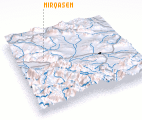 Places with similar names to Mīr Qāsem, Iran ::
Disclaimer :: Information on this page comes without warranty of any kind |
||
|
Where is Mīr Qāsem? Elevation and coordinates ::
Latitude (lat): 33°40'59"N Longitude (lon): 49°16'14"E
Elevation (approx.): 1902m (map arrows pan, magnifying glasses zoom) |
||
|
Visiting Mīr Qāsem? Hotel/Accommodation ::
Book a hotel in Mīr Qāsem Travel Guide ::
Buy a travel guide for Iran rental cars ::
car rental offers GPS waypoint ::
download a GPX waypoint (PoI) of Mīr Qāsem for your GPS receiver
|
||