|
search place name
|
||
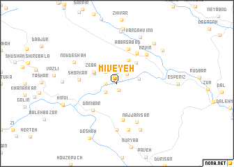
Mīveyeh (Ostān-e Kermānshāh, Iran)Mīveyeh is a town in the Ostān-e Kermānshāh region of Iran. An overview map of the region around Mīveyeh is displayed below.
regional and 3d topo map of Mīveyeh, Iran ::
Mīveyeh airports ::
The nearest airport is SDG - Sanandaj, located 64.0 km east of Mīveyeh.
Other airports nearby include KSH - Bakhtaran Shahid Ashrafi Esfahani (117.9 km south east), Nearby towns ::
Dāryān (1.1km south) //
Zalteh (1.5km west) //
Darreh Dūl (1.9km north) //
Ḩajīj-e Bozorg (2.0km north east) //
Varā (2.0km south west) //
Darreh Jaḩīj (2.4km north west) //
Bīnarovah (2.4km north west) //
Gīlvān (3.0km east) //
Ḩajīj-e Kūchek (3.4km north west) //
Ganjeh Nāv (4.0km north) //
Nesār (3.6km north west) //
Zebār (3.6km north west) //
Khānī Darreh (3.6km north west) //
Nāv (4.2km north east) //
Darī Bar (5.3km south west) //
Kaljī (5.5km north east) //
‘Abbāsābād (5.8km north) //
Najjār (6.0km south) //
Shorkān (5.0km west) //
Novīn (6.1km north east) //
Najjārī Sar (6.7km south east) //
Sūlcheh (7.4km south) //
Jānīsar (7.6km south) //
Lābard (7.6km south) //
Gol-e Voglān (7.6km south) //
Nowdeshah (6.6km north west) //
Shovī (8.0km south) //
Vargah Vīrā (8.0km north) //
Salīn (8.4km north) //
[all distances 'as the bird flies' and approximate] 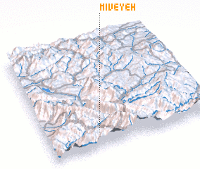 Places with similar names to Mīveyeh, Iran ::
Disclaimer :: Information on this page comes without warranty of any kind |
||
|
Where is Mīveyeh? Elevation and coordinates ::
Latitude (lat): 35°9'0"N Longitude (lon): 46°19'0"E
Elevation (approx.): 813m (map arrows pan, magnifying glasses zoom) |
||
|
Visiting Mīveyeh? Hotel/Accommodation ::
Book a hotel in Mīveyeh Travel Guide ::
Buy a travel guide for Iran rental cars ::
car rental offers GPS waypoint ::
download a GPX waypoint (PoI) of Mīveyeh for your GPS receiver
|
||