|
search place name
|
||
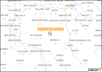
Mobārakābād (Iran)Mobārakābād is a town in Iran. An overview map of the region around Mobārakābād is displayed below.
regional and 3d topo map of Mobārakābād, Iran ::
Nearby towns ::
Bon Qal‘eh (3.1km south east) //
Nīlī (3.3km west) //
Seyyedābād (4.3km west) //
Moḩammad Zamān Khān (5.4km north east) //
Deh ‘Alī (5.1km south east) //
Now Deh Khāndūz (5.6km south west) //
Qareh Cheshmeh (5.6km north west) //
Balūchābād (5.8km north west) //
Sū Sarā (6.5km south) //
Largāh (6.3km south east) //
Markī Maḩalleh (5.8km east) //
‘Alī Naqī Khān (6.5km south west) //
Dasht Ḩalqeh (7.2km north west) //
Now Deh-e Esmā‘īl Khān (7.4km south west) //
Qorbānābād (6.4km south east) //
Sanchūlīābād-e Qalamī (8.3km north) //
Pas Poshteh (7.8km north east) //
Sarā Moḩammad Ḩoseyn (8.4km south) //
Qalamī (8.4km north) //
Sarān (7.4km south east) //
Sārāyū (8.8km south) //
Sārlī-ye Pā'īn (8.9km north) //
Ḩājjī Belkhān (9.2km north) //
Ḩeydar Kolāchī (9.4km north east) //
Marzīn (8.9km south west) //
Bālā Khān Ḩājjī (9.5km north west) //
Shāh Moḩammad (10.1km north east) //
[all distances 'as the bird flies' and approximate]  Places with similar names to Mobārakābād, Iran ::
// Mobārakābād (IR)
// Mobārakābād (IR)
// Mobārakābād (IR)
// Mobārakābād (IR)
// Mobārakābād (IR)
// Mobārakābād (IR)
// Mobārakābād (IR)
// Mobārakābād (IR)
// Mobārakābād (IR)
// Mobārakābād (IR)
Disclaimer :: Information on this page comes without warranty of any kind |
||
|
Where is Mobārakābād? Elevation and coordinates ::
Latitude (lat): 37°7'30"N Longitude (lon): 55°18'7"E
Elevation (approx.): 306m (map arrows pan, magnifying glasses zoom) |
||
|
Visiting Mobārakābād? Hotel/Accommodation ::
Book a hotel in Mobārakābād Travel Guide ::
Buy a travel guide for Iran rental cars ::
car rental offers GPS waypoint ::
download a GPX waypoint (PoI) of Mobārakābād for your GPS receiver
|
||