|
search place name
|
||
Mobārakābād-e Kalehrash (Kordestān, Iran)Mobārakābād-e Kalehrash is a town in the Kordestān region of Iran. An overview map of the region around Mobārakābād-e Kalehrash is displayed below.
regional and 3d topo map of Mobārakābād-e Kalehrash, Iran ::

Mobārakābād-e Kalehrash airports ::
The nearest airport is SDG - Sanandaj, located 35.7 km west of Mobārakābād-e Kalehrash.
Other airports nearby include KSH - Bakhtaran Shahid Ashrafi Esfahani (99.1 km south), Nearby towns ::
Javānmardābād (1.5km east) //
Majīdābād (1.5km east) //
Khvortū (1.5km west) //
Bāshmāq (3.9km south east) //
Karīmābād (4.0km north) //
Tāzehābād (4.8km north west) //
Sa‘īdābād (4.8km north east) //
Deh Golān (6.5km north) //
Melleh (6.3km south west) //
Kabūd Khānī-ye Soflá (5.9km south east) //
Serenjīāneh (6.0km south west) //
Cherāghābād (6.1km west) //
‘Alīābād-e Moshīr (6.1km east) //
Şādeqābād (7.6km south) //
Kabūd Khānī-ye ‘Olyā (7.2km south east) //
Ḩasanābād (7.2km north east) //
Qāder Marz (8.0km south) //
Sang Sīāh (7.1km south east) //
Kalkeh (8.2km south west) //
[all distances 'as the bird flies' and approximate] 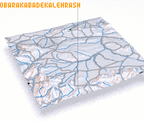 Places with similar names to Mobārakābād-e Kalehrash, Iran :: Disclaimer :: Information on this page comes without warranty of any kind |
||
|
Where is Mobārakābād-e Kalehrash? Elevation and coordinates ::
Latitude (lat): 35°13'0"N Longitude (lon): 47°24'0"E
Elevation (approx.): 1875m (map arrows pan, magnifying glasses zoom) |
||
|
Visiting Mobārakābād-e Kalehrash? Hotel/Accommodation ::
Book a hotel in Mobārakābād-e Kalehrash Travel Guide ::
Buy a travel guide for Iran rental cars ::
car rental offers GPS waypoint ::
download a GPX waypoint (PoI) of Mobārakābād-e Kalehrash for your GPS receiver
|
||