|
search place name
|
||
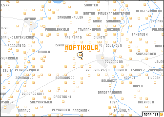
Moftī Kolā (Iran)Moftī Kolā is a town in Iran. An overview map of the region around Moftī Kolā is displayed below.
regional and 3d topo map of Moftī Kolā, Iran ::
Moftī Kolā airports ::
The nearest airport is THR - Teheran Mehrabad Intl, located 181.6 km south west of Moftī Kolā.
Nearby towns ::
Āghrow Kash (0.0km north) //
Lagan Dasht (0.0km north) //
Āboksar (1.3km north west) //
Ragan Dasht (1.9km north) //
‘Alī Kotī (1.5km west) //
Maleyed-e Mashhadī Kolā (1.9km south) //
Talū Kolā (1.5km west) //
Gorjī Kolā (1.9km south) //
Zervī Jān (1.7km south west) //
Bandār Kheyl (2.4km north east) //
Ākhvor Sar (2.4km north east) //
Pendār Kheyl (2.4km north east) //
Maleyek (2.4km south east) //
Salū Kolā (2.4km south west) //
Mashhadī Kolā (2.4km south west) //
Sheykh Kolā (2.4km south west) //
Sharafābād (3.1km north east) //
Līmūn (3.7km north) //
Dowlatābād (3.7km north) //
Qoroq (3.5km north east) //
Valīābād (4.0km north) //
Naşīr Sang (4.0km north) //
‘Īsá Khandaq (3.5km north west) //
Sharafdār Kolā-ye ‘Olyā (3.5km south west) //
Talū Bāgh (4.1km south) //
Rūd Posht (4.5km south) //
Sārī (3.7km east) //
Zargar Bāgh (4.8km north east) //
Pā'īn Sang Rīzeh (4.8km south east) //
[all distances 'as the bird flies' and approximate] 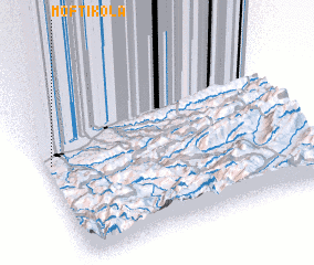 Places with similar names to Moftī Kolā, Iran ::
// Mufti Kili (PK)
Disclaimer :: Information on this page comes without warranty of any kind |
||
|
Where is Moftī Kolā? Elevation and coordinates ::
Latitude (lat): 36°34'0"N Longitude (lon): 53°1'0"E
Elevation (approx.): 16m (map arrows pan, magnifying glasses zoom) |
||
|
Visiting Moftī Kolā? Hotel/Accommodation ::
Book a hotel in Moftī Kolā Travel Guide ::
Buy a travel guide for Iran rental cars ::
car rental offers GPS waypoint ::
download a GPX waypoint (PoI) of Moftī Kolā for your GPS receiver
|
||