|
search place name
|
||
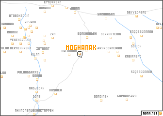
Moghānak (Tehrān, Iran)Moghānak is a town in the Tehrān region of Iran. An overview map of the region around Moghānak is displayed below.
regional and 3d topo map of Moghānak, Iran ::
Moghānak airports ::
The nearest airport is THR - Teheran Mehrabad Intl, located 87.0 km west of Moghānak.
Other airports nearby include RZR - Ramsar (206.9 km north west), Nearby towns ::
Āsīāb (1.8km north east) //
Owchūnak (2.4km west) //
Sorkheh Deh (4.8km north) //
Sarḩaddān-e Pa'īn (5.4km east) //
Zān (7.1km north west) //
Derakht-e Bīd (7.2km north east) //
Sarḩaddān (6.8km east) //
Qal‘eh-ye Ḩājjī ‘Asgar (6.9km west) //
Sarkhar (6.9km east) //
Zeyārat (7.3km west) //
Tūlkān (7.6km north west) //
Dozdābād (7.6km north west) //
Lūmān (8.1km north west) //
Sarlūmān (8.6km north west) //
Vīrāneh (9.6km south west) //
[all distances 'as the bird flies' and approximate] 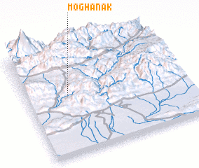 Places with similar names to Moghānak, Iran ::
Disclaimer :: Information on this page comes without warranty of any kind |
||
|
Where is Moghānak? Elevation and coordinates ::
Latitude (lat): 35°33'15"N Longitude (lon): 52°15'34"E
Elevation (approx.): 1768m (map arrows pan, magnifying glasses zoom) |
||
|
Visiting Moghānak? Hotel/Accommodation ::
Book a hotel in Moghānak Travel Guide ::
Buy a travel guide for Iran rental cars ::
car rental offers GPS waypoint ::
download a GPX waypoint (PoI) of Moghānak for your GPS receiver
|
||