|
search place name
|
||
Moḩammadābād (Yazd, Iran)Moḩammadābād is a town in the Yazd region of Iran. An overview map of the region around Moḩammadābād is displayed below.
regional and 3d topo map of Moḩammadābād, Iran ::

Moḩammadābād airports ::
The nearest airport is AZD - Yazd Shahid Sadooghi, located 48.6 km east of Moḩammadābād.
Nearby towns ::
Hemmatābād (1.5km east) //
Sa‘dābād (2.3km south east) //
Raḩmatābād (2.8km south east) //
Ramekān (3.5km south east) //
‘Alīābād (4.2km north west) //
Khūd-e Mīān (4.7km north west) //
Mazra‘eh-ye Moḩammad Ebrāhīm (5.0km east) //
Haūsh (5.1km north east) //
Khūd-e Pā'īn (5.7km north west) //
Mowrū (5.9km south east) //
Galia (6.0km south west) //
Dūlāb (7.7km north) //
Mazra‘eh-ye Khūt (7.7km north) //
Ḩasanābād (7.4km north west) //
Sar Cheshmeh (7.4km east) //
Ḩojjatābād (7.5km east) //
Dashtbānak (7.8km east) //
Maḩmūdābād (8.5km north west) //
Sūrok (9.2km south east) //
Bīdākhūneh (9.0km north east) //
[all distances 'as the bird flies' and approximate] 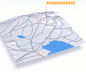 Places with similar names to Moḩammadābād, Iran ::
// Muhammadābād (IN)
// Muhammadābād (IN)
// Muhammadābād (IN)
// Muhammadābād (IN)
// Muhammadābād (IN)
// Muhammadābād (IN)
// Moḩammadābād (IR)
// Moḩammadābād (IR)
// Moḩammadābād (IR)
// Moḩammadābād (IR)
Disclaimer :: Information on this page comes without warranty of any kind |
||
|
Where is Moḩammadābād? Elevation and coordinates ::
Latitude (lat): 31°46'55"N Longitude (lon): 53°47'2"E
Elevation (approx.): 2518m (map arrows pan, magnifying glasses zoom) |
||
|
Visiting Moḩammadābād? Hotel/Accommodation ::
Book a hotel in Moḩammadābād Travel Guide ::
Buy a travel guide for Iran rental cars ::
car rental offers GPS waypoint ::
download a GPX waypoint (PoI) of Moḩammadābād for your GPS receiver
|
||