|
search place name
|
||
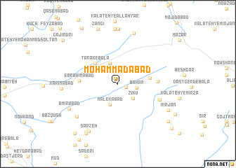
Moḩammadābād (Khorāsān, Iran)Moḩammadābād is a town in the Khorāsān region of Iran. An overview map of the region around Moḩammadābād is displayed below.
regional and 3d topo map of Moḩammadābād, Iran ::
Moḩammadābād airports ::
The nearest airport is XBJ - Birjand, located 36.1 km west of Moḩammadābād.
Nearby towns ::
Mahmachā (1.2km south east) //
Bahār (2.5km east) //
Zīku (3.1km south east) //
Malekābād (3.4km south) //
Esfazār (3.4km north) //
Ţanāk-e Bālā (4.5km north west) //
Boshgaz (4.4km east) //
Ţanāk-e Pā'īn (4.6km north west) //
Ebrāhīmābād (5.2km west) //
Boshgaz-e Pā'īn (5.3km east) //
Bīḩan (6.1km south east) //
Bījā'em (6.1km south east) //
Gāvak (7.6km south west) //
Kalāteh-ye Zangaz (8.4km north) //
Khūrī (8.7km north) //
Abījān (8.7km north) //
Amīrābād (7.7km south west) //
Sarzeh (8.5km south west) //
Kar (8.5km south west) //
Ḩoseynābād Gavāhī (8.5km south west) //
Mīr Jān (7.9km south east) //
Kor Moḩammadī (8.9km south west) //
Zangī (9.2km north) //
Morgh (9.0km south east) //
Sarji (9.8km south west) //
Eshtākhūn (10.1km north west) //
Darvīshābād (10.1km south east) //
Gajindri (10.1km north west) //
[all distances 'as the bird flies' and approximate] 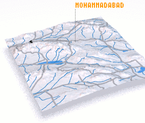 Places with similar names to Moḩammadābād, Iran ::
// Muhammadābād (IN)
// Muhammadābād (IN)
// Muhammadābād (IN)
// Muhammadābād (IN)
// Muhammadābād (IN)
// Muhammadābād (IN)
// Moḩammadābād (IR)
// Moḩammadābād (IR)
// Moḩammadābād (IR)
// Moḩammadābād (IR)
Disclaimer :: Information on this page comes without warranty of any kind |
||
|
Where is Moḩammadābād? Elevation and coordinates ::
Latitude (lat): 32°50'15"N Longitude (lon): 59°38'43"E
Elevation (approx.): 2048m (map arrows pan, magnifying glasses zoom) |
||
|
Visiting Moḩammadābād? Hotel/Accommodation ::
Book a hotel in Moḩammadābād Travel Guide ::
Buy a travel guide for Iran rental cars ::
car rental offers GPS waypoint ::
download a GPX waypoint (PoI) of Moḩammadābād for your GPS receiver
|
||