|
search place name
|
||
Moḩammadābād (Khorāsān, Iran)Moḩammadābād is a town in the Khorāsān region of Iran. An overview map of the region around Moḩammadābād is displayed below.
regional and 3d topo map of Moḩammadābād, Iran ::
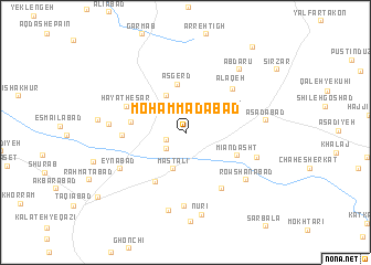
Nearby towns ::
‘Alī Āqā (1.7km south west) //
Nez̧āmīyeh (2.2km south west) //
Mast‘alī (3.8km south) //
Khān Ḩākem (3.6km north east) //
Sarhang (4.1km north) //
‘Asgerd (4.9km north) //
Kalāteh-ye Sheykh (4.6km west) //
Mīān Dasht (4.8km south east) //
Ḩeshmatābād (5.5km south west) //
Fatḩābād (5.2km west) //
‘Alāqeh (5.9km north east) //
Ḩayāt Ḩeşār (5.6km north west) //
Ja‘farābād (6.3km south east) //
Shūr Ḩeşār (7.5km south) //
‘Eynābād (6.6km south west) //
Dārāābād (6.4km south east) //
Fakhrābād (6.3km west) //
Rowshanābād (6.9km south east) //
Qajāq (8.0km south) //
Asadābād (6.7km east) //
Ābdārū (7.7km north east) //
Nūrī (8.3km south) //
Solţānābād (7.3km west) //
Gardaneh-ye Moḩammad Mīrzā (10.3km north east) //
Robāt Sang (9.7km south west) //
[all distances 'as the bird flies' and approximate] 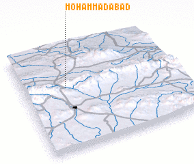 Places with similar names to Moḩammadābād, Iran ::
// Muhammadābād (IN)
// Muhammadābād (IN)
// Muhammadābād (IN)
// Muhammadābād (IN)
// Muhammadābād (IN)
// Muhammadābād (IN)
// Moḩammadābād (IR)
// Moḩammadābād (IR)
// Moḩammadābād (IR)
// Moḩammadābād (IR)
Disclaimer :: Information on this page comes without warranty of any kind |
||
|
Where is Moḩammadābād? Elevation and coordinates ::
Latitude (lat): 35°37'2"N Longitude (lon): 59°17'3"E
Elevation (approx.): 1657m (map arrows pan, magnifying glasses zoom) |
||
|
Visiting Moḩammadābād? Hotel/Accommodation ::
Book a hotel in Moḩammadābād Travel Guide ::
Buy a travel guide for Iran rental cars ::
car rental offers GPS waypoint ::
download a GPX waypoint (PoI) of Moḩammadābād for your GPS receiver
|
||