|
search place name
|
||
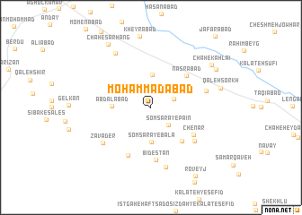
Moḩammadābād (Khorāsān, Iran)Moḩammadābād is a town in the Khorāsān region of Iran. An overview map of the region around Moḩammadābād is displayed below.
regional and 3d topo map of Moḩammadābād, Iran ::
Moḩammadābād airports ::
The nearest airport is HEA - Herat, located 220.9 km south east of Moḩammadābād.
Nearby towns ::
Qoz Ghāvah (2.5km north east) //
Somsarā-ye Pā'īn (2.8km south east) //
Chāh-e Ḩoseyn va Moḩammad-e Dūr Andīsh (3.3km north east) //
Chāh-e Qāsem-e Taklū (4.1km north) //
Chāh-e Gholāmreẕā Dūr Andīsh (3.7km north east) //
Somsarā-ye Bālā (4.3km south) //
Abdālābād (4.0km west) //
Ney Dar (5.2km south east) //
Naşrābād (5.4km north east) //
Chenār (5.5km south east) //
Bīdestān (6.6km south) //
Amīr Khvājeh (6.4km south) //
Shūrāb-e Jahān (6.1km south east) //
Chāh-e Moḩammad ‘Īsá (6.0km east) //
Zavāder (6.6km south west) //
Mokhālefgāh (7.6km south) //
Chāh-e Şalevātī va Ghoncheh ‘Alī (7.6km north west) //
Kheyrābād (8.9km north) //
Qal‘eh Sorkh (7.5km east) //
Chāh-e Kahlā'ī (8.1km north east) //
Qal‘eh-ye Sar Takht (8.1km north east) //
Chāh-e Sarhang (9.0km north west) //
Roveyj (9.7km south east) //
Ja‘farābād (11.0km north east) //
[all distances 'as the bird flies' and approximate] 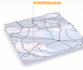 Places with similar names to Moḩammadābād, Iran ::
// Muhammadābād (IN)
// Muhammadābād (IN)
// Muhammadābād (IN)
// Muhammadābād (IN)
// Muhammadābād (IN)
// Muhammadābād (IN)
// Moḩammadābād (IR)
// Moḩammadābād (IR)
// Moḩammadābād (IR)
// Moḩammadābād (IR)
Disclaimer :: Information on this page comes without warranty of any kind |
||
|
Where is Moḩammadābād? Elevation and coordinates ::
Latitude (lat): 35°22'59"N Longitude (lon): 60°16'38"E
Elevation (approx.): 1177m (map arrows pan, magnifying glasses zoom) |
||
|
Visiting Moḩammadābād? Hotel/Accommodation ::
Book a hotel in Moḩammadābād Travel Guide ::
Buy a travel guide for Iran rental cars ::
car rental offers GPS waypoint ::
download a GPX waypoint (PoI) of Moḩammadābād for your GPS receiver
|
||