|
search place name
|
||
Mūrū'īyeh (Iran)Mūrū'īyeh is a town in Iran. An overview map of the region around Mūrū'īyeh is displayed below.
regional and 3d topo map of Mūrū'īyeh, Iran ::

Mūrū'īyeh airports ::
The nearest airport is KER - Kerman, located 167.1 km south east of Mūrū'īyeh.
Other airports nearby include AZD - Yazd Shahid Sadooghi (174.9 km west), Nearby towns ::
Khūsf (1.5km south) //
Khormātū (1.6km west) //
Chenārūʼīyeh (1.9km south) //
Dehmalek (1.9km north) //
Sandūʼīyeh (1.6km east) //
Bīdū Panj (1.6km east) //
Kabū (1.6km east) //
Deh Now (4.0km south east) //
Dasht-e Khān (4.0km north east) //
Bashgān (4.7km north west) //
Ḩājjīābād (4.9km south west) //
Banzeshkūn (5.6km north) //
Bīd Bashgān (5.8km north) //
Khorramābād (5.1km east) //
Torshīshū'īyeh (5.1km east) //
‘Azīzābād (5.1km east) //
Loţfābād (5.8km north) //
Deh Valāt (6.0km north east) //
Dehrīzūʼīyeh (6.4km north east) //
Bīdū (6.3km east) //
‘Abbāsābād (7.6km north) //
Jowzū'īyeh-ye Pā'īn (6.6km east) //
Jowzū'īyeh-ye Bālā (6.6km east) //
Shāhmīr (7.3km north west) //
Raḩmatābād (7.3km south east) //
‘Alīābād (7.3km north east) //
Senjetū'īyeh (8.1km north east) //
Kahn (8.0km south east) //
Tīgh Sefīd (8.4km south east) //
[all distances 'as the bird flies' and approximate] 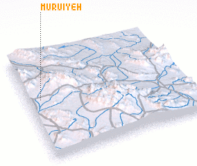 Places with similar names to Mūrū'īyeh, Iran ::
Disclaimer :: Information on this page comes without warranty of any kind |
||
|
Where is Mūrū'īyeh? Elevation and coordinates ::
Latitude (lat): 31°35'0"N Longitude (lon): 56°5'0"E
Elevation (approx.): 2092m (map arrows pan, magnifying glasses zoom) |
||
|
Visiting Mūrū'īyeh? Hotel/Accommodation ::
Book a hotel in Mūrū'īyeh Travel Guide ::
Buy a travel guide for Iran rental cars ::
car rental offers GPS waypoint ::
download a GPX waypoint (PoI) of Mūrū'īyeh for your GPS receiver
|
||