|
search place name
|
||
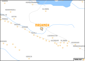
Naghmeh (Fārs, Iran)Naghmeh is a town in the Fārs region of Iran. An overview map of the region around Naghmeh is displayed below.
regional and 3d topo map of Naghmeh, Iran ::
Naghmeh airports ::
The nearest airport is KIH - Kish Island, located 119.3 km south east of Naghmeh.
Other airports nearby include BDH - Bandar Lengeh (175.0 km south east), Nearby towns ::
Sheykh ‘Āmer (3.2km south) //
Deh Now-e Fāẕelī (3.3km south west) //
Deh Now (3.7km south) //
Fāẕelī (3.9km south west) //
Chāh-e Chāhvarz (4.5km south) //
Dehbān (4.6km south) //
Lāvarestān (5.0km south east) //
Chāh Varz (5.4km south east) //
Deh Kohneh (5.1km west) //
Jūzaqdān (7.2km south east) //
Eḩshām (6.9km west) //
Pehrest-e Soflá (8.0km south east) //
‘Alīābād (8.6km north) //
Pehrest-e ‘Olyā (9.0km south east) //
‘Alīābād (8.9km south east) //
Najafābād (9.5km south east) //
[all distances 'as the bird flies' and approximate] 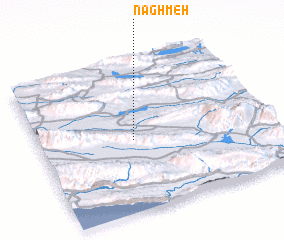 Places with similar names to Naghmeh, Iran ::
Disclaimer :: Information on this page comes without warranty of any kind |
||
|
Where is Naghmeh? Elevation and coordinates ::
Latitude (lat): 27°28'26"N Longitude (lon): 53°24'36"E
Elevation (approx.): 487m (map arrows pan, magnifying glasses zoom) |
||
|
Visiting Naghmeh? Hotel/Accommodation ::
Book a hotel in Naghmeh Travel Guide ::
Buy a travel guide for Iran rental cars ::
car rental offers GPS waypoint ::
download a GPX waypoint (PoI) of Naghmeh for your GPS receiver
|
||